Area Overview for Martlesham Heath
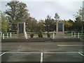
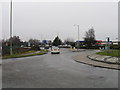
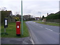
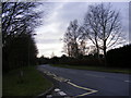
Photos of Martlesham Heath

Area Information
Martlesham Heath covers 1.9 square kilometres and functions as a built-up area within East Suffolk. Residents benefit from a compact layout that supports a straightforward commute to nearby Ipswich or Stowmarket. The location serves as a practical base for those working in the wider Ipswich Business Park or jetting into London. Daily life revolves around accessibility to major transport links rather than traditional town centres. You will find yourself crossing boundaries frequently as the area blends seamlessly with neighbouring residential zones. The physical footprint suggests a settled community where external transport arteries shape the internal rhythm. Living in Martlesham Heath offers a specific type of suburban convenience. You do not need to travel far to reach essential services or national railway hubs. The area size ensures a sense of locality while maintaining proximity to major job markets. This combination makes it an attractive option for commuters seeking a quieter alternative to larger urban districts. Homes in Martlesham Heath appeal to those prioritising transport access over immediate city centre vibrancy. The nature of the built-up area indicates a established residential fabric.
- Area Type
- Built Up Area 250
- Area Size
- 1.9 km²
- Population
- Not available
- Population Density
- Not available
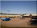
Residents accessing amenities in Martlesham Heath benefit from several retail outlets within practical reach. Aldi Gloster and Morrisons Daily Martlesham provide comprehensive grocery shopping options alongside M&S Martlesham Heath SF for clothing and household goods. This selection of five retail locations supports daily needs without requiring major journeys. The area also has significant rail access with five nearby stations including Entrance2, Woodbridge Railway Station, and Derby Road Railway Station. These transport hubs link you to regional employment centres and leisure destinations. Dining options and parks are not explicitly detailed in the current records, so you should explore locally. The presence of major supermarkets like Morrisons indicates a self-sufficient community environment. Shopping trips are resolved efficiently within the local vicinity. You can handle weekly grocery runs easily from your doorstep. The retail mix supports a quiet shopping experience rather than a high-street bustle. Living in Martlesham Heath means having essentials close at hand.
Amenities
Schools
Families considering schools near Martlesham Heath have access to Birchwood Primary School. This institution operates at an outstanding Ofsted rating, representing a high standard of education within the vicinity. The school serves as the primary educational option listed for the area. Primary education here benefits from this robust regulatory status. No secondary schools appear in the immediate data set for Martlesham Heath. Students likely commute to larger centres for high school attendance, given the absence of listed secondary options nearby. The presence of an outstanding-rated primary school suggests a committed local education authority. You can expect high standards in early years learning for children residing in the area. The limited school data means you must research further for secondary provision. Birchwood Primary School remains the local anchor for education.
| Rank | School | Type | Entry gender | Ages |
|---|
Explore more schools in this area
Go to Schools tabDemographics
The community profile reflects an older demographic with a significant portion of residents aged over seventy. The median age sits at seventy years, indicating a population dominated by retirees. This age distribution shapes the local economy and social infrastructure requirements. Fourteen percent of the residents fall outside this older bracket, bringing vitality to neighbourhood associations. Home ownership stands at eighty-one percent, creating a predominantly owner-occupied environment. This high level of tenure stability distinguishes Martlesham Heath from rental-heavy districts elsewhere in Suffolk. Accommodation types and household compositions align with this demographic reality. The population structure suggests a slower pace of life with specific generational influences on local character. Diversity metrics and predominant ethnic groups are not detailed in the available records, so these aspects remain unquantified here. You are joining a community where long-term residents likely hold significant sway. The high ownership figure means decisions regarding local improvements often involve established households. Understanding the age profile helps you anticipate the social atmosphere and future development patterns in the area.
Household Size
Accommodation Type
Tenure
Ethnic Group
Religion
Household Composition
Age
Household Deprivation
NS-SEC
Explore more demographic insights in this area
Go to Demographics tabPlanning
Planning Constraints
- Crime RiskPremium