Area Overview for Martins Wood Ward
Photos of Martins Wood Ward
Area Information
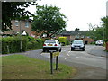
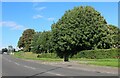
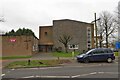
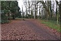
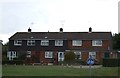
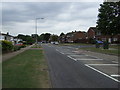
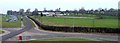
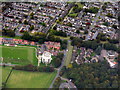
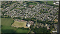
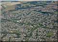
Living in Martins Wood Ward offers a distinctly quiet lifestyle within Wokingham, a borough known for its characterful villages and leafy neighbourhoods. This district borough unitary ward covers a compact area of just 1.2 square kilometres, creating a dense, focused community where residents know one another. The setting is primarily rural and established, providing a peaceful retreat from the busiest parts of the surrounding region. You will find a neighbourhood defined by its stability and lack of major planning obstacles such as protected wetlands or areas of outstanding natural beauty. Instead, the land includes small patches of protected woodland, which contribute to the local green infrastructure without imposing heavy development restrictions. Daily life here revolves around a tight-knit community feel rather than bustling commercial activity. The ward is small enough that you can walk to local amenities while retaining a rural atmosphere. There are no large parks or water bodies subject to conservation status, meaning the landscape is dominated by residential development and common woodland elements. This makes Martins Wood Ward a practical choice for those seeking a home in a low-risk environment with clear boundaries for future growth. The area's identity rests on its established nature, offering a stable backdrop for families and retirees alike without the volatility of rapidly changing urban zones.
- Area Type
- District Borough Unitary Ward
- Area Size
- 1.2 km²
- Population
- Not available
- Population Density
- Not available
Demographics
The community in Martins Wood Ward is defined by an older population. The median age here is 70 years, meaning half the residents are older than this figure and half are younger. This profile reflects a neighbourhood catering predominantly to retirees and mature households rather than young professionals or families. You will find most residents fall into the age brackets associated with post-retirement life, creating a demographic that values peace and proximity to services. With a home ownership rate of 58 per cent, the ward sits slightly below the national average, indicating a mix of owned properties and long-term rentals. The household composition points towards larger families living in multi-bedroom homes or couples down-sizing to smaller properties. This dynamic often results in an accommodation stock that suits older demographics well, including flats and semi-detached houses. While specific data on predominant ethnic groups and religious affiliations is not detailed in the current records, the stable age profile suggests a traditional British demographic structure common in leafy Thames Valley suburbs. There are no specific indicators in the available records to suggest significant diversity in religious practices, which aligns with the general pattern for rural wards in this county. You are entering an established community where life moves at a slower pace, driven by the needs and interests of a mature population.
Household Size
Accommodation Type
Tenure
Ethnic Group
Religion
Household Composition
Age
Household Deprivation
NS-SEC
Explore more demographic insights in this area
Go to Demographics tabPlanning
Planning Constraints
- Flood RiskPremium
- Ramsar Wetland SitesPremium
- Area of Outstanding Natural BeautyPremium
- Protected Nature ReservePremium
- Protected WoodlandPremium
- Crime RiskPremium