Area Overview for Marshes Ward
Photos of Marshes Ward
Area Information
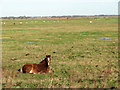
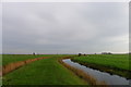
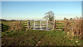
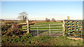
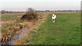
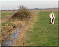
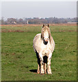
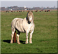
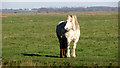
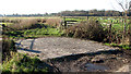
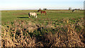
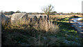
Living in Marshes Ward offers a distinct experience within the West Sussex landscape. This district borough unitary ward covers a significant expanse of 54.2 km², giving a spacious feel that defines daily life. The area is situated in England, where the open space and rural character are central to the neighbourhood identity. You will find yourself in an environment where the physical scale of the land shapes the rhythm of life for residents. The name Marshes Ward already hints at the geography, suggesting a community defined more by its terrain than dense urban sprawl. Prospective buyers looking at homes in Marshes Ward should understand that they are entering a region of considerable size. The large square kilometre count means distances between services can vary, so you must plan your commute carefully. Daily life here revolves around the local village centres rather than a high-density town core. The ward represents a specific slice of West Sussex where the layout encourages a slower pace. You are buying into a established pattern of settlement that predates modern suburban expansion. The area functions as a rural district where the primary吸引力 is the amount of open space available. There is no_attempt to describe the atmosphere as vibrant or bustling, because the reality of a 54 km² ward suggests a quieter existence. The character of Marshes Ward is set by its boundaries and the distance of travel required to reach commercial hubs. When you consider what living here entails, you must account for the sheer volume of ground you cover to access amenities. This distinguishes the ward from smaller, more compact districts where everything feels walking distance.
- Area Type
- District Borough Unitary Ward
- Area Size
- 54.2 km²
- Population
- Not available
- Population Density
- Not available
Demographics
The community in Marshes Ward is defined by a very specific age profile. You will find that the median age is 70 years old, which indicates a population largely made up of older residents. The most common age range data reflects this demographic shift towards those in their later years of life. Living in Marshes Ward means neighbours are likely to share similar life stages and interests. This concentration of older adults creates a stable, settled community where generational change happens slowly. Home ownership stands at a high level of 75% within the ward boundaries. This statistic reveals that the majority of households are owned outright or have a mortgage, rather than being tenant households. You are looking at an area where long-term residents have stayed through market fluctuations. High ownership rates often correlate with families staying put for decades rather than viewing properties for quick trades. This stability influences the local culture and supports local businesses in specific ways. The data provided covers the total household composition and accommodation types, but specific breakdowns for lone parent families or student households are not detailed. The predominant ethnic group, religious affiliation, and detailed deprivation figures are also summarised under total categories in the available records. Despite these general categories, the picture is clear: a mature community with predominantly owned homes. Understanding the 75% ownership figure helps you realise that resale markets might present differently than in new-build dominated zones. The demographic reality is one of retirement and long-term residency.
Household Size
Accommodation Type
Tenure
Ethnic Group
Religion
Household Composition
Age
Household Deprivation
NS-SEC
Explore more demographic insights in this area
Go to Demographics tabPlanning
Planning Constraints
- Flood RiskPremium
- Ramsar Wetland SitesPremium
- Area of Outstanding Natural BeautyPremium
- Protected Nature ReservePremium
- Protected WoodlandPremium
- Crime RiskPremium