Area Overview for Marshalswick West Ward
Photos of Marshalswick West Ward
Area Information
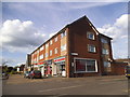
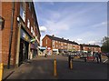
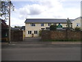
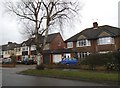
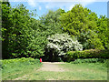
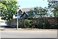
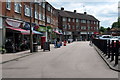
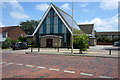
Marshalswick West Ward is a defined district within the City and District of St Albans, covering a total area of 1.6 square kilometres in Hertfordshire. Located approximately 1.5 miles northeast of St Albans city centre, this suburban neighbourhood sits within the broader municipal geography established in 1974. The area functions as a primarily residential hub, surrounded by neighbouring communities including Jersey Farm, Fleetville, and Bernards Heath. Historically, the site held significance long before modern housing developments, with records dating back to the thirteenth century when John and William Marschal owned the land between 1271 and 1377. Today, the landscape reflects its dual heritage, combining older housing from the 1920s and 1930s with a more substantial 1950s estate developed on former farm land. Key landmarks include The Quadrant neighbourhood centre, which houses shops and a library, and The Wick, a wooded park offering a playground and woodland walks for residents. St Mary's Church, established as an eccleisiastical parish in 1972, anchors the spiritual life of the community alongside several other local churches. For anyone considering living in Marshalswick West Ward, the area offers a structured suburban environment where history meets planned residential growth, providing a clear sense of place distinct from other parts of St Albans.
- Area Type
- District Borough Unitary Ward
- Area Size
- 1.6 km²
- Population
- Not available
- Population Density
- Not available
Demographics
The community profile within Marshalswick West Ward reveals an older demographic, with a median age of 70 years. This figure indicates that the population skews significantly towards seniors compared to the national average, suggesting a neighbourhood where many residents enjoy retirement or older family life. Specific age breakdowns beyond the median are not detailed in available records, but the overall tone points to a mature population structure. Home ownership stands at a high 79% across all households, which shapes the social fabric and financial stability of the area. With nearly four out of five residents owning their homes, the community likely features long-standing families and individuals who have invested in the local housing stock over decades. The data does not provide specific figures on household composition, such as the ratio of single-person households to families, nor does it list predominant ethnic groups or religious affiliations. These absences mean the diversity profile remains unclear, though the high ownership rate often correlates with stability. Residents here generally benefit from established neighbourhood connections, free from the transient nature of high rental turnover zones. The demographic reality suggests a quiet, settled environment where community ties are often rooted in shared history and property ownership rather than temporary residency.
Household Size
Accommodation Type
Tenure
Ethnic Group
Religion
Household Composition
Age
Household Deprivation
NS-SEC
Explore more demographic insights in this area
Go to Demographics tabPlanning
Planning Constraints
- Flood RiskPremium
- Ramsar Wetland SitesPremium
- Area of Outstanding Natural BeautyPremium
- Protected Nature ReservePremium
- Protected WoodlandPremium
- Crime RiskPremium