Area Overview for Marks Tey
Photos of Marks Tey


Area Information
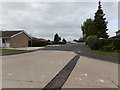
Living in Marks Tey means residing within an established built-up area that spans approximately 83.1 hectares. This community in England stands as a distinct residential locality rather than a sprawling urban sprawl, offering a defined sense of place for inhabitants. The area is characterised by its compact footprint, which fosters a neighbourhood feel where residents often know one another. You might find the pace of life moves at a steadier rhythm compared to larger metropolitan zones, yet essential services remain within practical reach. Prospective buyers should note that this is a traditional settlement with deep roots. The distinction of being a recognised town or city unit provides a framework for community identity that survives in the daily routines of locals. When you consider homes in Marks Tey, you are entering a space designed for long-term living rather than transient habitation. The environment supports a lifestyle where the boundary between home and local amenities is short, encouraging foot traffic and local engagement. This structure creates a stable backdrop for family life, where the physical layout supports a strong connection to the immediate surroundings. The area's size ensures that while it feels intimate, it retains the infrastructural capacity of a significant residential zone.
- Area Type
- Built Up Area 250
- Area Size
- 83.1 hectares
- Population
- Not available
- Population Density
- Not available
Daily life in Marks Tey is supported by a practical network of amenities within easy reach of your properties. Local retail options include a Spar, Aldi Stane, and M&S Stane, providing essentials without the need for lengthy car journeys. These supermarkets offer a range of food and household goods, catering to the weekly shopping habits of the predominantly older demographic. Beyond retail, the rail network offers four stations within practical reach, including Marks Tey Railway Station, Chappel & Wakes Colne Railway Station, and Kelvedon Railway Station. These transport hubs give you the option to travel beyond the local parish for wider employment or leisure opportunities. The combination of nearby retail and rail links ensures that Marks Tey feels self-sufficient while remaining connected to the broader county. You do not need to commute to distant towns for basic necessities, as the Spar and Aldi Stane are situated close to your home. The M&S Stane adds further variety to local shopping choices. This blend of local commerce and regional rail access creates a lifestyle where convenience meets connectivity, making Marks Tey a viable base for those who wish to maintain a low-car footprint while retaining access to wider opportunities.
Amenities
Schools
Families considering Marks Tey have access to specific primary education facilities nearby. The area lists two distinct primary schools: St Andrew's Church of England Voluntary Controlled Primary School, Marks Tey, and St Andrew's Church of England Primary Academy, Marks Tey. Both institutions operate at the primary level, serving children from early years through to age 11. The presence of two separate academies within the same neighbourhood suggests a capacity to handle different volumes of students or offers varied curricular focuses based on academy status. When evaluating schools near Marks Tey, you must note that the provided data confirms the existence and type of these institutions but does not include specific Ofsted ratings or exam performance data. Consequently, you will need to verify current regulatory standards independently. However, the dual presence of a Voluntary Controlled school and an Academy provides a subtle diversity in governance and potentially teaching methodologies. For parents in the area, this means there is choice within a small catchment zone. You will need to research individual inspection reports to determine which institution best fits your children's educational needs, as the local offering is concentrated at the primary stage.
| Rank | School | Type | Entry gender | Ages |
|---|
Explore more schools in this area
Go to Schools tabDemographics
The community profile of Marks Tey reveals significant demographic characteristics that define who lives here. The median age for residents stands at 70 years, indicating a population skewed heavily towards older demographics. This age distribution suggests that the area appeals strongly to retirees, those seeking to downsize, or families with older children leaving secondary education. Most common age ranges cluster around this high median, meaning the street scene is likely quieter during evenings and weekends compared to younger urban hubs. Home ownership levels are notably high, with 82% of households owning their homes outright or with a mortgage. This figure points to a stable estate where property values are often driven by local demand rather than rental yields. The high ownership rate implies strong community investment and a lower turnover of residents. As for accommodation types and household composition, the data presents the aggregate totals for the area, confirming a settled residential pattern. There is no indication of a transient population, reinforcing the idea of Marks Tey as a place for long-term anchors. This demographic stability means you can expect neighbours who have likely lived in the area for many years, creating a predictable and consistent social environment for new arrivals.
Household Size
Accommodation Type
Tenure
Ethnic Group
Religion
Household Composition
Age
Household Deprivation
NS-SEC
Explore more demographic insights in this area
Go to Demographics tabPlanning
Planning Constraints
- Crime RiskPremium