Area Overview for Margaretting
Photos of Margaretting


Area Information
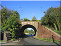
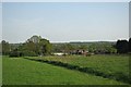
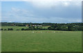
Margaretting is a built-up area covering 51.6 hectares, nestled within England. This neighbourhood presents a distinct character for those considering living in Margaretting. The setting is defined by its modest footprint, creating a concentrated community environment rather than a sprawling suburb. You will find that the layout supports a compact daily routine, where local amenities and neighbours are within close proximity. The area does not claim to be a sprawling metropolis but rather a specific settlement with clear boundaries. This scale influences the pace of life, offering a sense of familiarity that larger cities rarely provide. When you commit to homes in Margaretting, you are entering a space designed for efficiency and local interaction. The physical size suggests a manageable environment where travel distances to key facilities remain short. Living here means accepting the constraints of a smaller footprint in exchange for a more intimate neighbourhood dynamic. It is a place where the boundaries of daily life are clearly drawn, making it easy to navigate without needing a car for every trip. This self-contained nature defines the experience for any resident.
- Area Type
- Built Up Area 250
- Area Size
- 51.6 hectares
- Population
- Not available
- Population Density
- Not available
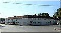
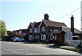
Daily life in Margaretting is supported by several nearby amenities within practical reach. Retail options are accessible, with five shops located close to the neighbourhood. Notable retailers include Budgens Ingatestone, Chelmsford Star Co-operative Society Co, and Budgens Stock. These stores provide essential shopping needs for any household. For commuters, rail transport is a key feature. There are four railway stations in close proximity, including Ingatestone Railway Station, Chelmsford Railway Station, and Billericay Railway Station. This rail network connects residents of Margaretting to wider employment hubs across Essex and London. The availability of four stations suggests good frequency of services and multiple route options. You can walk to a station or use public transport links easily without needing a private vehicle for every journey. The shopping and rail infrastructure creates a functional balance between local convenience and external connectivity. These amenities mean you do not have to leave the immediate region for groceries or daily travel needs. The combination of supermarkets and rail access defines the practical accessibility of this built-up area. Living in Margaretting allows you to maintain a local routine while retaining easy access to major towns via train.
Amenities
Schools
Education facilities near Margaretting are limited but specific. The only institution listed is the Margaretting Church of England Voluntary Controlled Primary School. This school serves as the primary educational option for children within this neighbourhood. Because the area has a median age of 70, the number of school-aged children in immediate proximity is likely small. The presence of just one primary school supports this quiet demographic reality. Families living in Margaretting would need to look beyond this single local option for secondary education, as the data does not list any comprehensives or grammar schools nearby. The school type is Voluntary Controlled, which means it is a community school with some independence in its religious ethos. While the rating of the school is not provided in the current dataset, the existence of this specific institution offers a clear choice for local primary education. You should verify the specific Ofsted rating through official channels before making decisions for your children. The reliance on this single primary school indicates a low density of young families. If you are relocating to Margaretting for school access, you must expand your search well beyond this built-up area to find suitable secondary options.
| Rank | School | Type | Entry gender | Ages |
|---|
Explore more schools in this area
Go to Schools tabDemographics
The community profile of Margaretting reveals an exceptionally older population. The median age stands at 70 years, marking this as one of the most mature neighbourhoods in the region. Most residents fall into the 'Age: Total' category, which highlights the uniformity of the age group within the area. This demographic structure suggests a quiet, settled community rather than a youthful enclave. Home ownership is the dominant force here, with 66% of residents owning their property. This high level of ownership indicates long-term stability and a lack of transient populations. You will encounter very few rented households, meaning neighbours are likely to stay put for generations. The accommodation types reflect this stability, favouring traditional ownership models over temporary tenancies. There is little evidence of rapid demographic shifts or new family migrations. The household composition aligns with this older demographic, suggesting families with children are less common than empty-nest retirees or couples. When you live in Margaretting, you are joining a group that shares similar life stages and likely similar priorities regarding quiet and stability. The lack of young families correlates directly with the high median age and strong ownership rates.