Area Overview for Manningtree
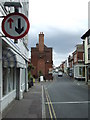
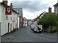
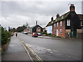
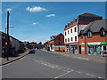
Photos of Manningtree


Area Information
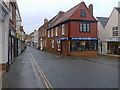
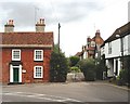
Manningtree stands as a distinct built-up area within Essex, spanning 41.3 hectares of land. You will find this community characterised by a quiet rhythm that suits residents seeking a settled life away from the rapid pace of larger metropolises. The area functions effectively as a local hub where daily needs are met close to home. Living in Manningtree means accessing a complete set of essentials within walking distance or a short drive. You can shop at nearby supermarkets, catch train services to wider destinations, and enjoy a neighbourhood defined by stability rather than rapid change. The compact size of this locality contributes to a manageable environment where you know your immediate surroundings. Homes in Manningtree are situated in an area that prioritises functional access to both retail and transport links. You do not need to travel far to find the basics required for a comfortable week. The local character reflects a community focused on practical living. This setting works well for those who value a predictable lifestyle with reliable access to services. You will notice a strong sense of place as you explore the town centre and its immediate vicinity.
- Area Type
- Built Up Area 250
- Area Size
- 41.3 hectares
- Population
- Not available
- Population Density
- Not available
Your daily life in Manningtree is centred on a compact range of amenities within immediate reach. Local retail needs are comfortably met by five key shops nearby, including the large store at Tesco Manningtree. This supermarket provides a one‑stop destination for groceries and household essentials. You will also find the East of England Co‑operative Company operating within the town, offering additional retail choices for food and drapery. For those who rely on train travel, the area boasts three railway stations. Manningtree Railway Station serves as the primary interchange point for local residents. You can also access Mistley and Wrabness stations for slightly different route options or expanded ticketing facilities. These transport hubs integrate seamlessly with local bus services. The convenience of having hyper‑local shopping and immediate rail access defines the lifestyle here. You will spend less time driving for daily errands. This proximity to both commercial and transit nodes allows for a balanced routine. Whether you are shopping at the Co‑op or catching a service from the main station, your needs are satisfied within a short walk or drive.
Amenities
Schools
| Rank | School | Type | Entry gender | Ages |
|---|
Explore more schools in this area
Go to Schools tabDemographics
The community profile in Manningtree reveals a significant concentration of older residents. The median age for the population is 70 years old, indicating that the area is primarily inhabited by seniors. You will find that the area does not cater to young families or a broad spread of age groups in the same way as larger suburban towns. This demographic skew shapes the local demands for housing and social services. Most households in this built-up area are arranged around the needs of those in retirement or later life stages. You may notice a prevalence of single‑person households or couples living together rather than large families with children. This statistical reality defines the social fabric of the neighbourhood. Home ownership remains a dominant feature of the local property landscape. A substantial 69% of residents own their homes outright or with a mortgage, creating a stable, owner‑occupied community. This high level of ownership supports long‑term investment and reduces transient tenancy rates. You will not find a significant proportion of private rental units. The population composition also reflects a settled demographic pattern. When you consider buying a home here, you are entering a market where permanence and established residency are the primary characteristics.
Household Size
Accommodation Type
Tenure
Ethnic Group
Religion
Household Composition
Age
Household Deprivation
NS-SEC
Explore more demographic insights in this area
Go to Demographics tabPlanning
Planning Constraints
- Crime RiskPremium