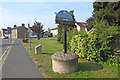
Area Overview for Manea
Photos of Manea


Area Information
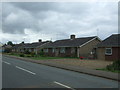
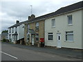
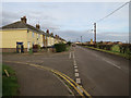
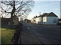
Living in Manea offers a distinct experience within theolk of the market town of March. You are settling into a built-up area covering 1.2 square kilometres. This compact size defines the daily rhythm of life, where distances are short and the community is close-knit. The area functions as a residential pocket with immediate access to key services, particularly transport links via the railway station. Residents find themselves situated in an environment that prioritises local convenience over the sprawl of larger cities. The character of Manea relies on its manageable footprint, ensuring that you do not spend excessive time commuting within the locality itself. Daily life centres around the handful of amenities available on your doorstep, such as the local railway station and nearby high street offers. While the area is small, it connects directly to the wider region through efficient public transport routes. You will appreciate the straightforward layout where essential services are within practical walking or cycling distance. The setting provides a stable base for homeownership, supported by a backdrop of established infrastructure rather than rapid urban development. Your quiet life here is anchored by a predictable environment where the population and housing stock have reached a mature balance.
- Area Type
- Built Up Area 250
- Area Size
- 1.2 km²
- Population
- Not available
- Population Density
- Not available
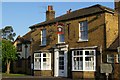
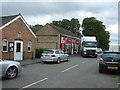
Daily life in Manea is defined by the cluster of amenities located within practical reach. You have immediate access to three categories of services that form the backbone of local convenience. There is one rail station, Manea Railway Station, providing essential external connectivity. For shopping needs, you will find five retail options nearby. Specific venues include Spar at Mill Hill Garage, M&S Littleport BP, and Co-op March. These outlets offer essential groceries and general goods without the need for a long journey. While this selection covers basic requirements, the small number of retail outlets reflects the area's rural nature. You will need to travel to the town of March for broader shopping, dining, or leisure activities not covered by these local stores. The character of these amenities is functional, focusing on daily necessities rather than vanity or luxury. Living in Manea means a lifestyle that values a Spar and a Co-op over a supermarket while prioritising the railway for wider travel. It is a practical arrangement for those who have the majority of needs met by a handful of local businesses.
Amenities
Schools
Families considering life in Manea have access to a single primary education option directly within their locality. The nearest school is Manea Community Primary School. This institution holds an Ofsted rating of good, indicating a standard of education that meets regulatory expectations. The area contains only one primary school, which means there is no secondary school within the immediate neighbourhood. You will need to look beyond the 1.2 km boundary for secondary education options, as no comprehensive or grammar school data is listed for Manor itself. The educational landscape is simple and focused, centred entirely around this one good-rated primary facility. For those living near Manea, the primary school is your sole choice for young children under the age of 11. The absence of other schools in the local cluster suggests a reliance on the main town of March for older pupils seeking secondary education. This concentration of facilities offers a straightforward choice for parents, though it lacks local variety.
| Rank | School | Type | Entry gender | Ages |
|---|
Explore more schools in this area
Go to Schools tabDemographics
The community in Manea reflects a settled population with a clear demographic profile. You will find the median age in this neighbourhood is 70 years old, indicating a community predominantly made up of older residents. The national age distribution is the most common range identified for the area's population structure. House stability is high, with 78% of homes being owner-occupied. This high rate of homeownership suggests a landed and invested community rather than one dependent on the private rental market. The data indicates no significant variation in household composition, points to a traditional family structure or single-occupancy living common in older estates. Accommodation types generally align with this ownership model, favouring houses over modern flats without specific diversity noted. The area lacks major fluctuations in ethnic or religious demographics, presenting a homogeneous social landscape typical of many rural English villages. This consistency creates a predictable social environment. Living in Manea means joining a population that has not seen recent influxes of young professionals or students, resulting in a quiet, stable atmosphere.
Household Size
Accommodation Type
Tenure
Ethnic Group
Religion
Household Composition
Age
Household Deprivation
NS-SEC
Explore more demographic insights in this area
Go to Demographics tabPlanning
Planning Constraints
- Crime RiskPremium