Area Overview for Lynford
Photos of Lynford
Area Information
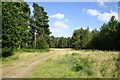
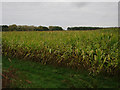
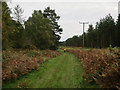
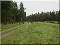
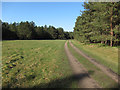
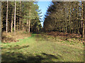
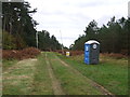
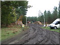
Lynford is a civil parish in England covering 24.7 km². It functions as a distinct local community with established boundaries and recognised rural characteristics. The area provides a setting where residents experience daily life without the pressures of large urban centres. You will find this to be a quiet, residential environment rather than a bustling commercial hub. The landscape is defined by its open space and low density, which shapes the pace of life for everyone who calls this parish home. For those considering living in Lynford, the primary appeal lies in its status as a traditional neighbourhood where noise levels remain low and the sense of space is plentiful. The physical size of the parish ensures that there is room for gardens and local boundaries without overcrowding. This makes it an attractive option for individuals prioritising tranquillity over proximity to city centres. When you search for homes in Lynford, you are looking at a specific microcosm of English rural life. The area maintains its identity as a separate parish, which often implies a strong sense of local history and governance. Your daily routine will be influenced by the layout of these 24.7 km², meaning your commute and leisure activities are defined by this specific geography. Living here offers a clear alternative to denser urban settings, providing a straightforward lifestyle centred on the house and immediate surroundings.
- Area Type
- Parish
- Area Size
- 24.7 km²
- Population
- Not available
- Population Density
- Not available
Demographics
The community profile of Lynford reveals a settlement dominated by an older population. Data indicates a median age of 70, making this one of the oldest parishes in the region. You will encounter a resident base where the majority are retirees or long-term residents rather than young families or students. The demographic structure shows Age as the Total category, confirming this age-skewed profile applies across the whole parish. Home ownership stands at an impressive 77%, which is significantly higher than the national average. This high percentage suggests a stable population where most families have settled permanently and possess their residences outright. Household composition within Lynford reflects this longevity, with traditional family structures often yielding to single-occupancy arrangements typical of retirement. There is no indication of a transient rental empire like those found near university towns. The accommodation type breakdown mirrors this stability, showing a total category without noted shortages in supply. You should expect to find mostly council housing or owner-occupied properties rather than temporary lets. While specific ethnic group and religious breakdowns are recorded as totals without further detail, the demographic picture remains clear: an age-dependent community. High deprivation levels are not mentioned in the available data, but the age profile itself implies specific economic difficulties. Many older residents may rely on pensions, which can impact local spending power. When looking at schools near Lynford, the proximity may be relevant for the small number of younger families who do remain, though the area is not populated by school-aged children in significant numbers.
Household Size
Accommodation Type
Tenure
Ethnic Group
Religion
Household Composition
Age
Household Deprivation
NS-SEC
Explore more demographic insights in this area
Go to Demographics tabPlanning
Planning Constraints
- Flood RiskLocked
- Ramsar Wetland SitesLocked
- Area of Outstanding Natural BeautyLocked
- Protected Nature ReserveLocked
- Protected WoodlandLocked
- Crime RiskLocked