Area Overview for LU7 9QJ
Photos of LU7 9QJ
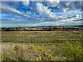
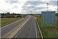
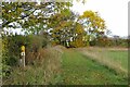

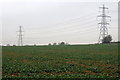

12 photos from this area
Area Information
Key information about the LU7 9QJ including its size, population, and administrative classification.
- Area Type
- Postcode
- Area Size
- 1.1 km²
- Population
- 1972
- Population Density
- 80 people/km²
House Prices in LU7 9QJ
9
Properties
£417,500
Average Sold Price
£370,000
Lowest Price
£500,000
Highest Price
Showing 9 properties
| Address | Type | Beds | Baths | Last Sale Price | Last Sale Date | |
|---|---|---|---|---|---|---|
| Berehul, 10 Hill Close, Wingfield, LU7 9QJ | Bungalow | - | - | £500,000 | Nov 2011 | |
| Greenacre, Hill Close, Wingfield, LU7 9QJ | Bungalow | - | - | £370,000 | Oct 2010 | |
| Hawthorns, Hill Close, Wingfield, LU7 9QJ | Detached | - | - | £400,000 | Jan 2009 | |
| Ashworth, Hill Close, Wingfield, LU7 9QJ | Detached | 3 | 2 | £400,000 | Jul 2004 | |
| The Annexe, Halworth Farm, Hill Close, Wingfield, LU7 9QJ | Flat | - | - | - | - | |
| Pavillion, Sports Ground, Tebworth Road, Wingfield, LU7 9QJ | Leisure | - | - | - | - | |
| The Annexe, Hill Farm, Hill Close, Wingfield, LU7 9QJ | house | - | - | - | - | |
| The Old Corn Barn, Hill Close, Wingfield, LU7 9QJ | house | - | - | - | - | |
| Hill Farm, Hill Close, Wingfield, LU7 9QJ | Terraced | 1 | - | - | - |
Energy Efficiency in LU7 9QJ
Amenities
Schools
| Rank | School | Type | Entry gender | Ages |
|---|
Explore more schools in this area
Go to Schools tabDemographics
Household Size
Two person
most common
Accommodation Type
Houses
most common
Tenure
81
majority
Ethnic Group
White
most common
Religion
N/A
most common
Household Composition
N/A
most common
Age
47
median
Adults (30-64 years)
most common
Household Deprivation
N/A
with no deprivation
NS-SEC
43
in Lower managerial occupations
Explore more demographic insights in this area
Go to Demographics tabPlanning
Planning Constraints
- Flood RiskPremium
- Ramsar Wetland SitesPremium
- Area of Outstanding Natural BeautyPremium
- Protected Nature ReservePremium
- Protected WoodlandPremium