Area Overview for LU7 9PU
Photos of LU7 9PU
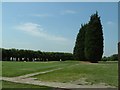
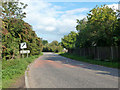
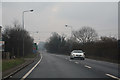
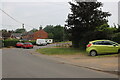

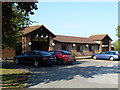

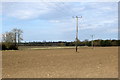
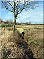

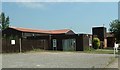

13 photos from this area
Area Information
Key information about the LU7 9PU including its size, population, and administrative classification.
- Area Type
- Postcode
- Area Size
- 1.1 km²
- Population
- 1972
- Population Density
- 80 people/km²
House Prices in LU7 9PU
58
Properties
£371,125
Average Sold Price
£87,000
Lowest Price
£700,000
Highest Price
Showing 58 properties
| Address | Type | Beds | Baths | Last Sale Price | Last Sale Date | |
|---|---|---|---|---|---|---|
| 16 Dunstable Road, Tilsworth, LU7 9PU | Detached | 3 | 1 | £580,000 | Jun 2024 | |
| 9 Dunstable Road, Tilsworth, LU7 9PU | Detached | 4 | 1 | £575,000 | Sep 2022 | |
| The Cottage, 1A Dunstable Road, Tilsworth, LU7 9PU | Detached | 2 | - | £415,000 | Aug 2022 | |
| 12 Dunstable Road, Tilsworth, LU7 9PU | Detached | 3 | - | £575,000 | Mar 2022 | |
| Orchard House, 28B Dunstable Road, Tilsworth, LU7 9PU | Detached | 3 | 2 | £700,000 | Feb 2022 | |
| 20 Dunstable Road, Tilsworth, LU7 9PU | Semi-detached | 4 | - | £486,666 | Mar 2021 | |
| 10 Dunstable Road, Tilsworth, LU7 9PU | Detached | 5 | 3 | £645,000 | Nov 2019 | |
| 45 Dunstable Road, Tilsworth, LU7 9PU | Semi-detached | 5 | 1 | £492,500 | Apr 2019 | |
| 11 Dunstable Road, Tilsworth, LU7 9PU | Detached | 4 | 2 | £555,000 | Mar 2018 | |
| 34 Dunstable Road, Tilsworth, LU7 9PU | Semi-detached | 3 | 1 | £390,000 | Feb 2018 |
Page 1 of 6
Energy Efficiency in LU7 9PU
Amenities
Schools
| Rank | School | Type | Entry gender | Ages |
|---|
Explore more schools in this area
Go to Schools tabDemographics
Household Size
Two person
most common
Accommodation Type
Houses
most common
Tenure
81
majority
Ethnic Group
White
most common
Religion
N/A
most common
Household Composition
N/A
most common
Age
47
median
Adults (30-64 years)
most common
Household Deprivation
N/A
with no deprivation
NS-SEC
43
in Lower managerial occupations
Explore more demographic insights in this area
Go to Demographics tabPlanning
Planning Constraints
- Flood RiskPremium
- Ramsar Wetland SitesPremium
- Area of Outstanding Natural BeautyPremium
- Protected Nature ReservePremium
- Protected WoodlandPremium