Area Overview for LU7 9JX
Photos of LU7 9JX


Area Information
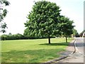
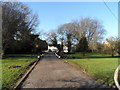
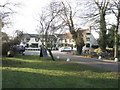
LU7 9JX is a small, low-density residential postcode area in England, home to 1,972 people spread across 80 individuals per square kilometre. This compact cluster of homes suggests a quiet, semi-rural character, likely with a focus on private housing rather than high-density development. The area’s demographic profile indicates a mature community, with a median age of 47 and a majority of residents aged 30–64. This suggests a stable, established population, possibly with families and professionals seeking a quieter lifestyle. Daily life here is likely to be unhurried, with local amenities and transport links providing practical connectivity without the bustle of larger towns. The absence of major planning constraints or environmental designations means development is likely unencumbered, though the area’s small size means it is not a hub for commercial or cultural activity. For those prioritising space, safety, and a settled community, LU7 9JX offers a straightforward, no-frills residential experience.
- Area Type
- Postcode
- Area Size
- Not available
- Population
- 1972
- Population Density
- 80 people/km²
The property market in LU7 9JX is characterised by high home ownership (81%) and a predominance of houses over flats. This suggests a market skewed towards owner-occupied homes rather than rental properties, which may indicate a desire for long-term stability among residents. The absence of flats or apartments implies a lack of high-density housing, which could limit options for buyers seeking smaller or more affordable properties. Given the area’s small size, the immediate surroundings likely offer similar housing stock, with limited scope for new developments. For buyers, this means a focus on existing homes, though the relatively low population density may also mean fewer competing offers. The market is likely to be niche, appealing to those prioritising private, family-friendly housing over urban convenience.
House Prices in LU7 9JX
No properties found in this postcode.
Energy Efficiency in LU7 9JX
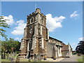
The immediate vicinity of LU7 9JX includes five retail outlets, such as Co-op Leighton, Tesco Houghton, and Morrisons Daily, providing access to everyday shopping and groceries. These stores cater to daily needs, though the absence of dining or leisure venues suggests a focus on practicality over entertainment. The rail network offers links to nearby areas, enhancing mobility for those reliant on public transport. While the area lacks detailed information on parks or recreational spaces, the combination of retail and rail access implies a lifestyle prioritising convenience and connectivity over expansive leisure options.
Amenities
Schools
The nearest school to LU7 9JX is Stanbridge Lower School, a primary school with a ‘good’ Ofsted rating. This provides a solid foundation for families with young children, though no secondary schools are listed in the data. The presence of a primary school within practical reach suggests that the area is suitable for families requiring early education, but parents seeking secondary schooling may need to look further afield. The absence of additional schools or educational institutions means that the area’s appeal is likely limited to those with younger children or those willing to commute for higher education.
| Rank | School | Type | Entry gender | Ages |
|---|
Explore more schools in this area
Go to Schools tabDemographics
The population of LU7 9JX is predominantly middle-aged, with a median age of 47 and 81% of residents owning their homes. This high home ownership rate, combined with the prevalence of houses over flats, suggests a community of long-term residents rather than transient renters. The majority of residents fall within the 30–64 age range, indicating a mix of families, professionals, and retirees. The predominant ethnic group is White, though no specific data on diversity or deprivation is provided. The absence of detailed socioeconomic metrics means it is difficult to assess wealth distribution or access to services, but the age profile implies a stable, low-turnover community. This demographic structure may influence local services and amenities, with a focus on needs such as schools, healthcare, and retirement support.
Household Size
Accommodation Type
Tenure
Ethnic Group
Religion
Household Composition
Age
Household Deprivation
NS-SEC
Explore more demographic insights in this area
Go to Demographics tabPlanning
Planning Constraints
- Flood RiskPremium
- Ramsar Wetland SitesPremium
- Area of Outstanding Natural BeautyPremium
- Protected Nature ReservePremium
- Protected WoodlandPremium