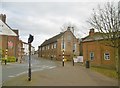
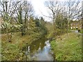
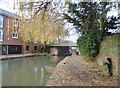
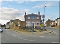
Area Overview for LU7 7RF
Photos of LU7 7RF

Area Information
LU7 7RF is a small, tightly knit postcode area in England, home to 1,543 residents living at a density of 1,362 people per square kilometre. This compact cluster of homes reflects a quiet, residential character, where daily life is shaped by proximity to local amenities and transport links. The area’s size means it is likely centred around a core of established housing, with limited expansion potential. Residents here are likely to find a balance between suburban comfort and easy access to nearby towns. The population density suggests a mix of family homes and smaller properties, though the exact layout remains unspoken. For those considering living in LU7 7RF, the area offers a sense of community within a small footprint, with no major urban sprawl or industrial presence. Its appeal lies in its simplicity: a place where routine needs are met without the pressures of larger cities. The absence of significant environmental constraints, such as protected woodlands or flood-prone zones, adds to its practicality for homebuyers seeking stability.
- Area Type
- Postcode
- Area Size
- Not available
- Population
- 1543
- Population Density
- 1362 people/km²
The property market in LU7 7RF is dominated by owner-occupied homes, with 82% of residents living in properties they own. This high rate of home ownership suggests a stable, long-term demographic, with limited rental activity. The accommodation type is exclusively houses, which is unusual for a small postcode area but may indicate a mix of older, larger properties or semi-detached homes. Given the compact size of LU7 7RF, the housing stock is likely to be limited in number, with little scope for new developments. Buyers should consider that the area’s small footprint may mean competition for properties, particularly given the high ownership rate. For those seeking a home in LU7 7RF, the focus is on established, family-friendly housing rather than a dynamic rental market.
House Prices in LU7 7RF
No properties found in this postcode.
Energy Efficiency in LU7 7RF
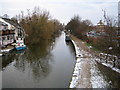
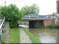
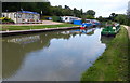
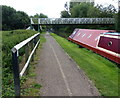
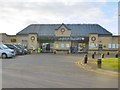
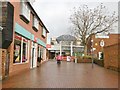
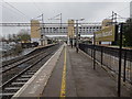
Living in LU7 7RF provides access to a range of nearby amenities, including five retail outlets such as Tesco Leighton, Spar, and Aldi Leighton. These shops offer essential goods, making daily errands convenient for residents. The area’s rail network, with stations at Leighton Buzzard, Cheddington, and Fenny Stratford, connects residents to broader transport routes, facilitating travel to larger towns or cities. While the data does not specify parks or leisure facilities, the absence of environmental constraints like protected woodlands or AONB designations suggests that the area is not heavily regulated, potentially allowing for local recreational spaces. The mix of retail and rail access contributes to a practical lifestyle, where residents can meet both everyday needs and travel requirements without significant effort.
Amenities
Schools
The nearest school to LU7 7RF is Sutherlands School, an independent institution. This type of school typically offers a private education model, often with smaller class sizes and specialized curricula. While no Ofsted rating is provided, the presence of an independent school suggests that families in the area may prioritise educational choice. However, the data does not include information on state schools or other nearby educational institutions. The absence of additional schools means that parents may need to look beyond LU7 7RF for a broader range of options. For those valuing independent education, Sutherlands School provides a direct option, but the area’s limited school diversity could be a consideration for families seeking multiple choices.
| Rank | School | Type | Entry gender | Ages |
|---|
Explore more schools in this area
Go to Schools tabDemographics
The population of LU7 7RF is predominantly adults aged 30–64, with a median age of 47. This suggests a mature, settled community, likely with established careers and families. Home ownership is high, at 82%, indicating a strong presence of long-term residents rather than transient renters. The accommodation type is primarily houses, which aligns with the area’s residential character and density. The predominant ethnic group is White, reflecting a homogenous demographic profile. While this data does not include specific information on deprivation levels, the high home ownership and low crime risk (score 85) imply a relatively stable quality of life. The absence of detailed diversity metrics means the area’s social fabric is not extensively documented, but the figures provided suggest a community focused on continuity and security.
Household Size
Accommodation Type
Tenure
Ethnic Group
Religion
Household Composition
Age
Household Deprivation
NS-SEC
Explore more demographic insights in this area
Go to Demographics tabPlanning
Planning Constraints
- Flood RiskPremium
- Ramsar Wetland SitesPremium
- Area of Outstanding Natural BeautyPremium
- Protected Nature ReservePremium
- Protected WoodlandPremium