Area Overview for LU7 4WA
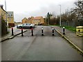
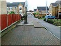
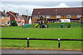
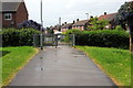
Photos of LU7 4WA


Area Information
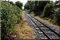
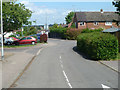
LU7 4WA is a small, tightly knit residential postcode in England, home to 1,806 people. Its compact size means it feels more like a quiet village than a sprawling suburb, with a focus on stability and community. The area’s population is predominantly adults aged 30–64, reflecting a mature, established demographic. Daily life here is shaped by proximity to essential services and a low crime rate, making it appealing for those seeking a peaceful yet practical lifestyle. Residents benefit from easy access to two railway stations—Leighton Buzzard and Cheddington—linking them to nearby towns and cities. The presence of local retailers such as Co-op Leighton and Morrisons Daily ensures everyday needs are met without long journeys. With no significant environmental constraints or flood risks, LU7 4WA offers a straightforward, low-maintenance living environment. Its small scale means the area is unlikely to change dramatically, preserving its character for current and future residents.
- Area Type
- Postcode
- Area Size
- Not available
- Population
- 1806
- Population Density
- 9135 people/km²
The property market in LU7 4WA is characterised by high home ownership—69% of residents own their homes—and a predominance of houses over flats or other accommodation types. This suggests a market skewed towards owner-occupation, with limited rental activity. The small size of the area means the housing stock is likely to be tightly held, with few new developments or turnover. For buyers, this implies a need to act quickly when opportunities arise, as properties may not be frequently listed. The focus on houses also means the area is unlikely to attract younger buyers or those seeking smaller, more affordable units. Those considering LU7 4WA should be prepared for a market that prioritises long-term residency over short-term investment. The low crime risk and absence of planning constraints further enhance the appeal of owning property here, making it a secure choice for those seeking stability.
House Prices in LU7 4WA
No properties found in this postcode.
Energy Efficiency in LU7 4WA
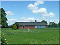
Living in LU7 4WA offers a blend of convenience and simplicity, with essential retail and transport options within reach. The area is served by five retail outlets, including Co-op Leighton and two Morrisons stores, providing access to groceries, household goods, and everyday services. These shops cater to both routine needs and occasional shopping trips, reducing the necessity for long journeys. The two nearby railway stations—Leighton Buzzard and Cheddington—offer direct links to surrounding towns, enabling easy access to cultural, professional, and recreational opportunities. While the area lacks large parks or leisure facilities, its compact nature ensures that amenities are close to home. This balance of practicality and proximity makes LU7 4WA ideal for those who value a straightforward lifestyle without the complexities of urban living.
Amenities
Schools
| Rank | School | Type | Entry gender | Ages |
|---|
Explore more schools in this area
Go to Schools tabDemographics
The community in LU7 4WA is defined by its mature age profile, with a median age of 47 and the majority of residents falling within the 30–64 age range. This suggests a population largely composed of working-age adults and older families, contributing to a stable, long-term settlement pattern. Home ownership is high at 69%, indicating a strong preference for private property over rentals, which is typical of smaller, residential areas. The accommodation type is predominantly houses, reflecting a more traditional, low-density housing stock. The predominant ethnic group is White, with no data provided on other groups. This demographic profile points to a community with established roots, where most residents are likely to have lived in the area for several years. The absence of specific deprivation data means the quality of life here is inferred from the low crime rate and access to basic amenities, suggesting a reasonably comfortable standard of living.
Household Size
Accommodation Type
Tenure
Ethnic Group
Religion
Household Composition
Age
Household Deprivation
NS-SEC
Explore more demographic insights in this area
Go to Demographics tabPlanning
Planning Constraints
- Flood RiskPremium
- Ramsar Wetland SitesPremium
- Area of Outstanding Natural BeautyPremium
- Protected Nature ReservePremium
- Protected WoodlandPremium