Area Overview for LU7 4TP
Photos of LU7 4TP
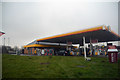

12 photos from this area
Area Information
Key information about the LU7 4TP including its size, population, and administrative classification.
- Area Type
- Postcode
- Area Size
- 1.2 hectares
- Population
- 1216
- Population Density
- 3443 people/km²
House Prices in LU7 4TP
46
Properties
£208,554
Average Sold Price
£121,000
Lowest Price
£380,000
Highest Price
Showing 46 properties
| Address | Type | Beds | Baths | Last Sale Price | Last Sale Date | |
|---|---|---|---|---|---|---|
| 21 Johnson Drive, Leighton Buzzard, LU7 4TP | Terraced | 2 | 1 | £290,000 | Jun 2025 | |
| 38 Johnson Drive, Leighton Buzzard, LU7 4TP | Terraced | 3 | 1 | £310,000 | Jun 2025 | |
| 24 Johnson Drive, Leighton Buzzard, LU7 4TP | Retail | 3 | 2 | £380,000 | Sep 2022 | |
| 17 Johnson Drive, Leighton Buzzard, LU7 4TP | house | - | - | £380,000 | Sep 2022 | |
| 4 Johnson Drive, Leighton Buzzard, LU7 4TP | Flat | - | - | £157,000 | Jun 2022 | |
| 10 Johnson Drive, Leighton Buzzard, LU7 4TP | Flat | - | - | £165,000 | Mar 2022 | |
| 7 Johnson Drive, Leighton Buzzard, LU7 4TP | Detached | 3 | 2 | £300,000 | Nov 2020 | |
| 56 Johnson Drive, Leighton Buzzard, LU7 4TP | Terraced | 3 | - | £240,500 | Jun 2020 | |
| 40 Johnson Drive, Leighton Buzzard, LU7 4TP | Terraced | 3 | 1 | £258,000 | Jun 2020 | |
| 23 Johnson Drive, Leighton Buzzard, LU7 4TP | house | 2 | 1 | £224,000 | Dec 2019 |
Page 1 of 5
Energy Efficiency in LU7 4TP
Amenities
Schools
| Rank | School | Type | Entry gender | Ages |
|---|
Explore more schools in this area
Go to Schools tabDemographics
Household Size
Family (3-5 people)
most common
Accommodation Type
Houses
most common
Tenure
60
majority
Ethnic Group
White
most common
Religion
N/A
most common
Household Composition
N/A
most common
Age
47
median
Adults (30-64 years)
most common
Household Deprivation
N/A
with no deprivation
NS-SEC
37
in Lower managerial occupations
Explore more demographic insights in this area
Go to Demographics tabPlanning
Planning Constraints
- Flood RiskPremium
- Ramsar Wetland SitesPremium
- Area of Outstanding Natural BeautyPremium
- Protected Nature ReservePremium
- Protected WoodlandPremium