Area Overview for LU7 4SW
Photos of LU7 4SW
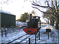
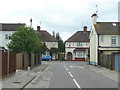
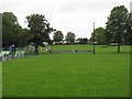
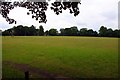
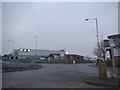
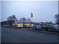
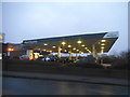
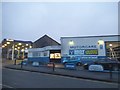

65 photos from this area
Area Information
Key information about the LU7 4SW including its size, population, and administrative classification.
- Area Type
- Postcode
- Area Size
- 1.2 hectares
- Population
- 1375
- Population Density
- 661 people/km²
House Prices in LU7 4SW
7
Properties
£297,833
Average Sold Price
£280,000
Lowest Price
£318,500
Highest Price
Showing 7 properties
| Address | Type | Beds | Baths | Last Sale Price | Last Sale Date | |
|---|---|---|---|---|---|---|
| 58 Grovebury Road, Leighton Buzzard, LU7 4SW | Semi-detached | 2 | 1 | £295,000 | Jun 2024 | |
| 56 Grovebury Road, Leighton Buzzard, LU7 4SW | Bungalow | 2 | 1 | £280,000 | May 2020 | |
| 54 Grovebury Road, Leighton Buzzard, LU7 4SW | Bungalow | 3 | 1 | £318,500 | Feb 2015 | |
| Unit 7A, Ridgeway Court, Grovebury Road, Leighton Buzzard, LU7 4SW | commercial | - | - | - | - | |
| Inwards Motors, 50 Grovebury Road, Leighton Buzzard, LU7 4SW | shop | - | - | - | - | |
| A E H Inwards Motors Ltd, 48 Grovebury Road, Leighton Buzzard, LU7 4SW | Industrial | - | - | - | - | |
| Unit 3, Ridgeway Court, Grovebury Road, Leighton Buzzard, LU7 4SW | Industrial | - | - | - | - |
Energy Efficiency in LU7 4SW
Amenities
Schools
| Rank | School | Type | Entry gender | Ages |
|---|
Explore more schools in this area
Go to Schools tabDemographics
Household Size
Family (3-5 people)
most common
Accommodation Type
Houses
most common
Tenure
84
majority
Ethnic Group
White
most common
Religion
N/A
most common
Household Composition
N/A
most common
Age
47
median
Adults (30-64 years)
most common
Household Deprivation
N/A
with no deprivation
NS-SEC
50
in Lower managerial occupations
Explore more demographic insights in this area
Go to Demographics tabPlanning
Planning Constraints
- Flood RiskPremium
- Ramsar Wetland SitesPremium
- Area of Outstanding Natural BeautyPremium
- Protected Nature ReservePremium
- Protected WoodlandPremium