Area Overview for LU7 4QS
Photos of LU7 4QS


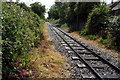

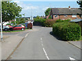
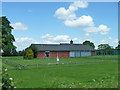


17 photos from this area
Area Information
Key information about the LU7 4QS including its size, population, and administrative classification.
- Area Type
- Postcode
- Area Size
- 3168 m²
- Population
- 1806
- Population Density
- 9135 people/km²
House Prices in LU7 4QS
12
Properties
£225,665
Average Sold Price
£126,995
Lowest Price
£370,000
Highest Price
Showing 12 properties
| Address | Type | Beds | Baths | Last Sale Price | Last Sale Date | |
|---|---|---|---|---|---|---|
| 14 Nettleton Close, Leighton Buzzard, LU7 4QS | Semi-detached | 3 | 1 | £302,500 | Mar 2024 | |
| 12 Nettleton Close, Leighton Buzzard, LU7 4QS | house | 3 | 2 | £370,000 | Aug 2022 | |
| 4 Nettleton Close, Leighton Buzzard, LU7 4QS | Retail | 3 | 1 | £360,000 | Jun 2022 | |
| 20 Nettleton Close, Leighton Buzzard, LU7 4QS | Semi-detached | 3 | - | £285,000 | Aug 2018 | |
| 16 Nettleton Close, Leighton Buzzard, LU7 4QS | Terraced | 3 | - | £193,000 | Apr 2013 | |
| 18 Nettleton Close, Leighton Buzzard, LU7 4QS | Semi-detached | 3 | 1 | £185,000 | Apr 2010 | |
| 10 Nettleton Close, Leighton Buzzard, LU7 4QS | house | - | - | £205,000 | Dec 2007 | |
| 22 Nettleton Close, Leighton Buzzard, LU7 4QS | Detached | - | - | £200,000 | Oct 2004 | |
| 2 Nettleton Close, Leighton Buzzard, LU7 4QS | Semi-detached | 3 | - | £187,500 | Dec 2003 | |
| 24 Nettleton Close, Leighton Buzzard, LU7 4QS | Detached | - | - | £148,995 | Apr 2002 |
Page 1 of 2
Energy Efficiency in LU7 4QS
Amenities
Schools
| Rank | School | Type | Entry gender | Ages |
|---|
Explore more schools in this area
Go to Schools tabDemographics
Household Size
Family (3-5 people)
most common
Accommodation Type
Houses
most common
Tenure
69
majority
Ethnic Group
White
most common
Religion
N/A
most common
Household Composition
N/A
most common
Age
47
median
Adults (30-64 years)
most common
Household Deprivation
N/A
with no deprivation
NS-SEC
39
in Lower managerial occupations
Explore more demographic insights in this area
Go to Demographics tabPlanning
Planning Constraints
- Flood RiskPremium
- Ramsar Wetland SitesPremium
- Area of Outstanding Natural BeautyPremium
- Protected Nature ReservePremium
- Protected WoodlandPremium