Area Overview for LU7 3UW
Photos of LU7 3UW
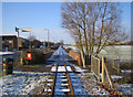
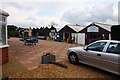


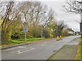
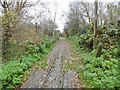


22 photos from this area
Area Information
Key information about the LU7 3UW including its size, population, and administrative classification.
- Area Type
- Postcode
- Area Size
- 5313 m²
- Population
- 1475
- Population Density
- 1869 people/km²
House Prices in LU7 3UW
21
Properties
£194,213
Average Sold Price
£71,000
Lowest Price
£367,500
Highest Price
Showing 21 properties
| Address | Type | Beds | Baths | Last Sale Price | Last Sale Date | |
|---|---|---|---|---|---|---|
| 59 Almond Road, Leighton Buzzard, LU7 3UW | Terraced | 3 | 1 | £318,000 | Sep 2025 | |
| 50 Almond Road, Leighton Buzzard, LU7 3UW | Semi-detached | 3 | 1 | £285,000 | Oct 2022 | |
| 60 Almond Road, Leighton Buzzard, LU7 3UW | Maisonette | - | - | £130,000 | Sep 2022 | |
| 54 Almond Road, Leighton Buzzard, LU7 3UW | Detached | 3 | 1 | £367,500 | Jul 2022 | |
| 62 Almond Road, Leighton Buzzard, LU7 3UW | house | 2 | 1 | £260,000 | May 2022 | |
| 46 Almond Road, Leighton Buzzard, LU7 3UW | house | - | - | £295,000 | Sep 2021 | |
| 57 Almond Road, Leighton Buzzard, LU7 3UW | house | 2 | - | £155,000 | Sep 2014 | |
| 61 Almond Road, Leighton Buzzard, LU7 3UW | house | - | - | £172,500 | Jul 2014 | |
| 48 Almond Road, Leighton Buzzard, LU7 3UW | house | - | - | £195,000 | Dec 2011 | |
| 52 Almond Road, Leighton Buzzard, LU7 3UW | Semi-detached | 3 | 2 | £181,000 | Jan 2008 |
Page 1 of 3
Energy Efficiency in LU7 3UW
Amenities
Schools
| Rank | School | Type | Entry gender | Ages |
|---|
Explore more schools in this area
Go to Schools tabDemographics
Household Size
Two person
most common
Accommodation Type
Houses
most common
Tenure
83
majority
Ethnic Group
White
most common
Religion
N/A
most common
Household Composition
N/A
most common
Age
47
median
Adults (30-64 years)
most common
Household Deprivation
N/A
with no deprivation
NS-SEC
32
in Lower managerial occupations
Explore more demographic insights in this area
Go to Demographics tabPlanning
Planning Constraints
- Flood RiskPremium
- Ramsar Wetland SitesPremium
- Area of Outstanding Natural BeautyPremium
- Protected Nature ReservePremium
- Protected WoodlandPremium