Area Overview for LU7 2TW
Photos of LU7 2TW
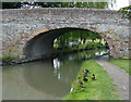
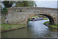
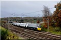
32 photos from this area
Area Information
Key information about the LU7 2TW including its size, population, and administrative classification.
- Area Type
- Postcode
- Area Size
- 7.9 hectares
- Population
- 1099
- Population Density
- 1447 people/km²
House Prices in LU7 2TW
14
Properties
£308,167
Average Sold Price
£82,000
Lowest Price
£525,000
Highest Price
Showing 14 properties
| Address | Type | Beds | Baths | Last Sale Price | Last Sale Date | |
|---|---|---|---|---|---|---|
| 8 Chestnut Rise, Linslade, LU7 2TW | Bungalow | 3 | 2 | £525,000 | Dec 2023 | |
| 1 Chestnut Rise, Linslade, LU7 2TW | Bungalow | 2 | 1 | £440,000 | Sep 2021 | |
| 5 Chestnut Rise, Linslade, LU7 2TW | Bungalow | 2 | 1 | £385,000 | Aug 2020 | |
| 14 Chestnut Rise, Linslade, LU7 2TW | Bungalow | - | - | £380,000 | Mar 2016 | |
| 9 Chestnut Rise, Linslade, LU7 2TW | Bungalow | - | - | £300,000 | Nov 2015 | |
| 7 Chestnut Rise, Linslade, LU7 2TW | Bungalow | 3 | - | £390,000 | Sep 2015 | |
| 4 Chestnut Rise, Linslade, LU7 2TW | Detached | - | - | £125,500 | Dec 2000 | |
| 6 Chestnut Rise, Linslade, LU7 2TW | Terraced | - | - | £146,000 | Feb 1999 | |
| 12 Chestnut Rise, Linslade, LU7 2TW | Bungalow | 2 | 1 | £82,000 | Mar 1997 | |
| 11 Chestnut Rise, Linslade, LU7 2TW | Detached | - | - | - | - |
Page 1 of 2
Energy Efficiency in LU7 2TW
Amenities
Schools
| Rank | School | Type | Entry gender | Ages |
|---|
Explore more schools in this area
Go to Schools tabDemographics
Household Size
Two person
most common
Accommodation Type
Houses
most common
Tenure
92
majority
Ethnic Group
White
most common
Religion
N/A
most common
Household Composition
N/A
most common
Age
47
median
Adults (30-64 years)
most common
Household Deprivation
N/A
with no deprivation
NS-SEC
45
in Lower managerial occupations
Explore more demographic insights in this area
Go to Demographics tabPlanning
Planning Constraints
- Flood RiskPremium
- Ramsar Wetland SitesPremium
- Area of Outstanding Natural BeautyPremium
- Protected Nature ReservePremium
- Protected WoodlandPremium