Area Overview for LU7 2TE
Photos of LU7 2TE
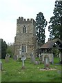
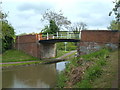
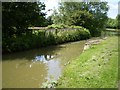
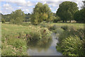
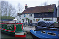
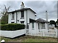

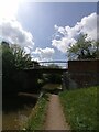
58 photos from this area
Area Information
Key information about the LU7 2TE including its size, population, and administrative classification.
- Area Type
- Postcode
- Area Size
- 9.2 hectares
- Population
- 1543
- Population Density
- 1362 people/km²
House Prices in LU7 2TE
11
Properties
£339,300
Average Sold Price
£169,000
Lowest Price
£565,000
Highest Price
Showing 11 properties
| Address | Type | Beds | Baths | Last Sale Price | Last Sale Date | |
|---|---|---|---|---|---|---|
| Kelvedon, Bossington Lane, Linslade, LU7 2TE | Detached | 4 | 2 | £565,000 | Oct 2023 | |
| Cotswold, Bossington Lane, Linslade, LU7 2TE | Bungalow | 4 | 2 | £517,500 | Aug 2015 | |
| Turtles Meadow, Bossington Lane, Linslade, LU7 2TE | Bungalow | - | - | £225,000 | Aug 2000 | |
| The Herons, Bossington Lane, Linslade, LU7 2TE | Detached | - | - | £220,000 | Jul 1999 | |
| Sandy Rise, Bossington Lane, Linslade, LU7 2TE | Detached | - | - | £169,000 | Apr 1999 | |
| Romany, Bossington Lane, Linslade, LU7 2TE | Detached | - | - | - | - | |
| The Barn, Bossington Lane, Linslade, LU7 2TE | Detached | - | - | - | - | |
| St Helier, Bossington Lane, Linslade, LU7 2TE | Semi-detached | - | - | - | - | |
| Tenaya, Bossington Lane, Linslade, LU7 2TE | Detached | - | - | - | - | |
| Wroxleigh, Bossington Lane, Linslade, LU7 2TE | Detached | - | - | - | - |
Page 1 of 2
Energy Efficiency in LU7 2TE
Amenities
Schools
| Rank | School | Type | Entry gender | Ages |
|---|
Explore more schools in this area
Go to Schools tabDemographics
Household Size
Two person
most common
Accommodation Type
Houses
most common
Tenure
82
majority
Ethnic Group
White
most common
Religion
N/A
most common
Household Composition
N/A
most common
Age
47
median
Adults (30-64 years)
most common
Household Deprivation
N/A
with no deprivation
NS-SEC
45
in Lower managerial occupations
Explore more demographic insights in this area
Go to Demographics tabPlanning
Planning Constraints
- Flood RiskPremium
- Ramsar Wetland SitesPremium
- Area of Outstanding Natural BeautyPremium
- Protected Nature ReservePremium
- Protected WoodlandPremium