Area Overview for LU6 3WG
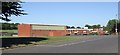
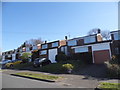
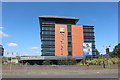
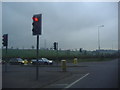
Photos of LU6 3WG


Area Information
LU6 3WG is a small, tightly knit residential postcode in England, home to 1,788 people. Its compact nature means it feels like a quiet, self-contained community, ideal for those seeking a balance between suburban comfort and proximity to larger urban hubs. The area is predominantly occupied by adults aged 30–64, with a median age of 47, suggesting a stable population of homeowners and families. Daily life here is shaped by its practical layout and strong local amenities. With easy access to major transport links, including four railway stations and London Luton Airport, residents enjoy seamless connectivity to nearby cities and beyond. The area’s low crime risk and absence of environmental constraints like protected woodlands or wetlands make it a safe, straightforward place to live. Its small size means it’s not a sprawling suburb but a focused cluster of homes, offering a sense of familiarity and community. For buyers, LU6 3WG presents a chance to own a property in a place that combines practicality with a low-maintenance lifestyle, all within reach of retail, transport, and leisure options.
- Area Type
- Postcode
- Area Size
- Not available
- Population
- 1788
- Population Density
- 5847 people/km²
The property market in LU6 3WG is characterised by high home ownership, with 84% of residents living in owner-occupied homes. This suggests a market dominated by long-term residents rather than rental properties, which is unusual for smaller postcode areas. The accommodation type is predominantly houses, indicating a lack of high-density housing such as flats or apartments. This makes LU6 3WG a niche area for buyers seeking single-family homes in a low-risk, stable environment. The absence of planning constraints like protected woodlands or AONB designations means property development is unlikely to be restricted, though the small population size limits the scale of the market. For buyers, this means a focus on individual properties rather than larger estates or commercial developments. The area’s proximity to transport hubs and amenities also adds to its appeal, though its small size means it is best suited for those prioritising convenience over expansive living spaces.
House Prices in LU6 3WG
No properties found in this postcode.
Energy Efficiency in LU6 3WG
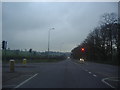
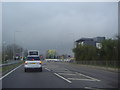
Living in LU6 3WG offers a blend of convenience and accessibility. Within practical reach are five retail outlets, including Co-op Lowther, Tesco Dunstable, and Lidl Luton, providing everyday shopping needs. The area’s railway stations — Leagrave, Luton, and Luton Airport Parkway — connect residents to London and other destinations, while London Luton Airport, just 2km away, offers international travel options. Though the area is small, its proximity to larger centres means residents can enjoy urban amenities without the density. The retail and transport infrastructure supports a lifestyle that balances local self-sufficiency with regional access. The absence of major parks or leisure facilities within the postcode itself means residents must look to nearby towns for recreation, but the area’s compact nature ensures that essential services are never far. This makes LU6 3WG suitable for those who prioritise ease of access over sprawling green spaces.
Amenities
Schools
| Rank | School | Type | Entry gender | Ages |
|---|
Explore more schools in this area
Go to Schools tabDemographics
The community in LU6 3WG is defined by its mature demographic profile. With a median age of 47 and 84% of residents owning their homes, the area is largely populated by long-term residents rather than younger renters or transient populations. The most common age range is 30–64, indicating a mix of middle-aged professionals and families. Accommodation is predominantly houses, reflecting a preference for single-family living over flats or apartments. The predominant ethnic group is White, though no data is provided on other groups or diversity metrics. The high home ownership rate suggests a stable, established community with limited turnover. This demographic profile means the area is unlikely to experience rapid change or gentrification, offering a consistent living environment for residents. The absence of specific deprivation data means the quality of life here is not explicitly tied to socioeconomic factors, though the low crime risk and safety score of 74/100 imply a generally secure and orderly neighbourhood.
Household Size
Accommodation Type
Tenure
Ethnic Group
Religion
Household Composition
Age
Household Deprivation
NS-SEC
Explore more demographic insights in this area
Go to Demographics tabPlanning
Planning Constraints
- Flood RiskPremium
- Ramsar Wetland SitesPremium
- Area of Outstanding Natural BeautyPremium
- Protected Nature ReservePremium
- Protected WoodlandPremium