Area Overview for LU6 2PE
Photos of LU6 2PE
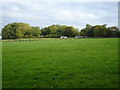

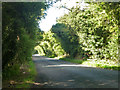
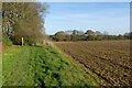
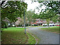
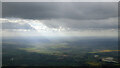
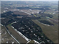
7 photos from this area
Area Information
Key information about the LU6 2PE including its size, population, and administrative classification.
- Area Type
- Postcode
- Area Size
- 9.0 hectares
- Population
- 1638
- Population Density
- 99 people/km²
House Prices in LU6 2PE
40
Properties
£632,578
Average Sold Price
£155,000
Lowest Price
£1,390,000
Highest Price
Showing 40 properties
| Address | Type | Beds | Baths | Last Sale Price | Last Sale Date | |
|---|---|---|---|---|---|---|
| Tanglewood, 16 Oakway, Studham, LU6 2PE | Detached | 4 | 2 | £750,000 | Sep 2024 | |
| Donroc, 19 Oakway, Studham, LU6 2PE | Bungalow | 4 | 2 | £990,000 | Sep 2024 | |
| High Trees, 23 Oakway, Studham, LU6 2PE | Bungalow | 3 | - | £902,500 | Apr 2023 | |
| The Cedars, 39 Oakway, Studham, LU6 2PE | Bungalow | 4 | 4 | £1,390,000 | Nov 2022 | |
| Willow Tree Lodge, 29 Oakway, Studham, LU6 2PE | Retail | 4 | 3 | £885,000 | May 2022 | |
| 1A Oakway, Studham, LU6 2PE | Detached | 4 | 4 | £950,000 | Dec 2021 | |
| Oaklea, 8 Oakway, Studham, LU6 2PE | Detached | 5 | 3 | £965,000 | Sep 2020 | |
| Springfield Lodge, 33 Oakway, Studham, LU6 2PE | house | 5 | - | £825,000 | Dec 2018 | |
| Greenwood, 15 Oakway, Studham, LU6 2PE | house | - | - | £830,000 | Feb 2018 | |
| St Margarets, 36 Oakway, Studham, LU6 2PE | Detached | - | - | £811,000 | Dec 2016 |
Page 1 of 4
Energy Efficiency in LU6 2PE
Amenities
Schools
| Rank | School | Type | Entry gender | Ages |
|---|
Explore more schools in this area
Go to Schools tabDemographics
Household Size
Two person
most common
Accommodation Type
Houses
most common
Tenure
88
majority
Ethnic Group
White
most common
Religion
N/A
most common
Household Composition
N/A
most common
Age
47
median
Adults (30-64 years)
most common
Household Deprivation
N/A
with no deprivation
NS-SEC
45
in Lower managerial occupations
Explore more demographic insights in this area
Go to Demographics tabPlanning
Planning Constraints
- Flood RiskPremium
- Ramsar Wetland SitesPremium
- Area of Outstanding Natural BeautyPremium
- Protected Nature ReservePremium
- Protected WoodlandPremium