Area Overview for LU6 2AW
Photos of LU6 2AW
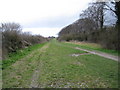
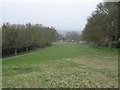
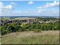

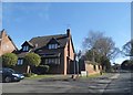
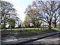
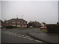
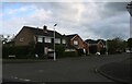
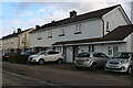
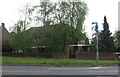
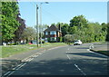
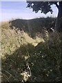
29 photos from this area
Area Information
Key information about the LU6 2AW including its size, population, and administrative classification.
- Area Type
- Postcode
- Area Size
- 1.8 hectares
- Population
- 1456
- Population Density
- 1909 people/km²
House Prices in LU6 2AW
26
Properties
£338,800
Average Sold Price
£145,000
Lowest Price
£700,000
Highest Price
Showing 26 properties
| Address | Type | Beds | Baths | Last Sale Price | Last Sale Date | |
|---|---|---|---|---|---|---|
| 13 Lancot Avenue, Dunstable, LU6 2AW | Detached | 4 | 2 | £700,000 | Jul 2024 | |
| 2A Lancot Avenue, Dunstable, LU6 2AW | house | - | - | £415,000 | Apr 2015 | |
| 19 Lancot Avenue, Dunstable, LU6 2AW | Detached | 4 | 2 | £375,000 | Mar 2014 | |
| 18 Lancot Avenue, Dunstable, LU6 2AW | house | 4 | - | £395,000 | Nov 2012 | |
| Deakin House, 15 Lancot Avenue, Dunstable, LU6 2AW | Detached | 4 | 2 | £365,000 | Oct 2012 | |
| 16 Lancot Avenue, Dunstable, LU6 2AW | Detached | - | - | £336,000 | Jun 2007 | |
| 23 Lancot Avenue, Dunstable, LU6 2AW | Detached | 5 | 3 | £237,000 | Jul 2002 | |
| 24 Lancot Avenue, Dunstable, LU6 2AW | Semi-detached | 3 | - | £247,000 | Mar 2001 | |
| 14 Lancot Avenue, Dunstable, LU6 2AW | Detached | - | - | £173,000 | Apr 1999 | |
| 22 Lancot Avenue, Dunstable, LU6 2AW | Detached | - | - | £145,000 | Jul 1996 |
Page 1 of 3
Energy Efficiency in LU6 2AW
Amenities
Schools
| Rank | School | Type | Entry gender | Ages |
|---|
Explore more schools in this area
Go to Schools tabDemographics
Household Size
Two person
most common
Accommodation Type
Houses
most common
Tenure
93
majority
Ethnic Group
White
most common
Religion
N/A
most common
Household Composition
N/A
most common
Age
47
median
Adults (30-64 years)
most common
Household Deprivation
N/A
with no deprivation
NS-SEC
41
in Lower managerial occupations
Explore more demographic insights in this area
Go to Demographics tabPlanning
Planning Constraints
- Flood RiskPremium
- Ramsar Wetland SitesPremium
- Area of Outstanding Natural BeautyPremium
- Protected Nature ReservePremium
- Protected WoodlandPremium