Area Overview for LU6 1XR
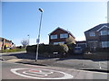
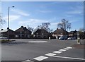
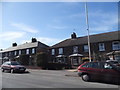
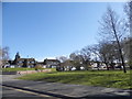
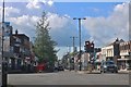
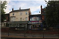
Photos of LU6 1XR


Area Information
LU6 1XR is a small, tightly knit residential area in England, home to 1,835 people. Its compact size means it feels like a quiet, manageable community, with a focus on family-oriented living. The area’s demographic profile suggests a mature population, with a median age of 47 and most residents falling within the 30–64 age range. This suggests a stable, established community, likely with a mix of long-term residents and families. The presence of a primary school, Ashton St Peter’s VA C of E School, rated ‘good’ by Ofsted, indicates that the area is well-suited for families seeking quality education. Proximity to multiple railway stations—Leagrave, Luton, and Harlington—offers easy access to regional transport networks. The area’s low flood risk, absence of protected natural sites, and below-average crime rate all contribute to a sense of safety and practicality. For those prioritising convenience, the cluster of retail outlets including Co-op Dunstable and Tesco Dunstable High ensures daily needs are met without needing to travel far. LU6 1XR balances suburban comfort with accessibility, making it a viable choice for those seeking a settled, low-maintenance lifestyle.
- Area Type
- Postcode
- Area Size
- Not available
- Population
- 1835
- Population Density
- 8207 people/km²
LU6 1XR is predominantly a home-owning area, with 56% of properties owned by residents rather than rented. This suggests a market where long-term investment is more common than short-term tenancy, which can stabilise property values. The accommodation type is primarily houses, which contrasts with areas dominated by flats or apartments. This housing stock likely appeals to families and professionals seeking space and privacy. Given the area’s small size, property availability is limited, and buyers may need to consider nearby postcode areas for more options. The presence of multiple railway stations within reach—Leagrave, Luton, and Harlington—enhances the area’s appeal for commuters, though the emphasis on owner-occupation means rental properties are less prevalent. For those prioritising a settled lifestyle, the mix of houses and proximity to transport infrastructure makes LU6 1XR a practical choice. However, the limited property pool may require flexibility in location or timing for buyers.
House Prices in LU6 1XR
No properties found in this postcode.
Energy Efficiency in LU6 1XR
Daily life in LU6 1XR is shaped by its proximity to retail hubs and transport links. The area’s five retail outlets—Co-op Dunstable, Iceland Dunstable, and Tesco Dunstable High—provide a range of shopping options, from essentials to larger grocery needs. These stores are likely within a short walk or drive, reducing the need for long commutes. The five nearby railway stations—Leagrave, Luton, and Harlington—offer frequent services, connecting residents to broader networks. While the data does not specify parks or leisure facilities, the absence of planning constraints like AONBs or protected woodlands suggests open spaces may be available nearby. The area’s character is defined by practicality, with amenities focused on convenience rather than luxury. For those valuing accessibility and a straightforward lifestyle, LU6 1XR’s mix of retail, transport, and educational facilities provides a functional, low-stress environment.
Amenities
Schools
The primary school closest to LU6 1XR is Ashton St Peter’s VA C of E School, which serves the area’s younger residents. Rated ‘good’ by Ofsted, it offers a solid educational foundation for children aged 4–11. While the data does not mention secondary schools, the presence of a primary school with a strong rating is a significant draw for families. The school’s religious affiliation as a Church of England institution may align with the area’s predominantly White and mature demographic. For parents, this school provides a reliable option for early education, though those requiring secondary schooling may need to look beyond LU6 1XR. The single school listed suggests a focus on primary education, which is typical for smaller communities. The quality of this institution, combined with the area’s safety profile, makes it a key consideration for prospective buyers with children.
| Rank | School | Type | Entry gender | Ages |
|---|
Explore more schools in this area
Go to Schools tabDemographics
The population of LU6 1XR skews towards adults aged 30–64, with a median age of 47. This suggests a community of established professionals and families, rather than a younger or elderly demographic. Home ownership is strong, with 56% of residents owning their homes, indicating a stable housing market. The predominant accommodation type is houses, which aligns with the area’s character as a residential cluster. The ethnic composition is largely White, reflecting broader regional trends. While specific data on deprivation is not provided, the low crime rate and presence of essential amenities suggest a relatively high quality of life. The absence of significant demographic diversity may appeal to those seeking a homogeneous community but could limit cultural variety. The age profile and home ownership rates together imply a place where long-term residency is common, with fewer transient populations. This stability can be advantageous for families seeking continuity in schools and local services.
Household Size
Accommodation Type
Tenure
Ethnic Group
Religion
Household Composition
Age
Household Deprivation
NS-SEC
Explore more demographic insights in this area
Go to Demographics tabPlanning
Planning Constraints
- Flood RiskPremium
- Ramsar Wetland SitesPremium
- Area of Outstanding Natural BeautyPremium
- Protected Nature ReservePremium
- Protected WoodlandPremium