Area Overview for LU6 1UW
Photos of LU6 1UW


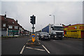
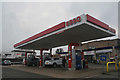
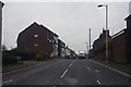
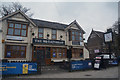

59 photos from this area
Area Information
Key information about the LU6 1UW including its size, population, and administrative classification.
- Area Type
- Postcode
- Area Size
- 4743 m²
- Population
- 2247
- Population Density
- 7237 people/km²
House Prices in LU6 1UW
20
Properties
£168,925
Average Sold Price
£26,000
Lowest Price
£405,000
Highest Price
Showing 20 properties
| Address | Type | Beds | Baths | Last Sale Price | Last Sale Date | |
|---|---|---|---|---|---|---|
| 16 Sheriden Close, Dunstable, LU6 1UW | Detached | 3 | - | £405,000 | Oct 2024 | |
| 9 Sheriden Close, Dunstable, LU6 1UW | Terraced | 2 | 1 | £270,000 | Dec 2023 | |
| 20 Sheriden Close, Dunstable, LU6 1UW | Detached | 3 | 2 | £321,500 | Oct 2018 | |
| 12 Sheriden Close, Dunstable, LU6 1UW | Terraced | 2 | 1 | £240,000 | Oct 2017 | |
| 2 Sheriden Close, Dunstable, LU6 1UW | house | - | - | £158,800 | Mar 2012 | |
| 19 Sheriden Close, Dunstable, LU6 1UW | house | - | - | £241,000 | May 2011 | |
| 6 Sheriden Close, Dunstable, LU6 1UW | house | - | - | £142,000 | Jan 2011 | |
| 8 Sheriden Close, Dunstable, LU6 1UW | house | - | - | £130,000 | Mar 2009 | |
| 7 Sheriden Close, Dunstable, LU6 1UW | house | - | - | £140,000 | Jun 2005 | |
| 10 Sheriden Close, Dunstable, LU6 1UW | Terraced | 2 | 1 | £148,000 | Apr 2005 |
Page 1 of 2
Energy Efficiency in LU6 1UW
Amenities
Schools
| Rank | School | Type | Entry gender | Ages |
|---|
Explore more schools in this area
Go to Schools tabDemographics
Household Size
One person
most common
Accommodation Type
Flats
most common
Tenure
48
majority
Ethnic Group
White
most common
Religion
N/A
most common
Household Composition
N/A
most common
Age
47
median
Adults (30-64 years)
most common
Household Deprivation
N/A
with no deprivation
NS-SEC
28
in Lower managerial occupations
Explore more demographic insights in this area
Go to Demographics tabPlanning
Planning Constraints
- Flood RiskPremium
- Ramsar Wetland SitesPremium
- Area of Outstanding Natural BeautyPremium
- Protected Nature ReservePremium
- Protected WoodlandPremium