Area Overview for LU6 1UU
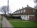
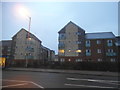
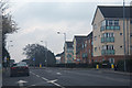
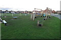
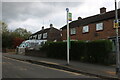
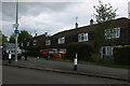
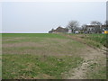
Photos of LU6 1UU

Area Information
LU6 1UU is a compact residential postcode in England, covering 9,480 square metres and home to 1,605 residents. Its high population density—169,305 people per square kilometre—reflects a tightly knit community. This area is defined by its small-scale living, with houses forming the predominant accommodation type. Daily life here is shaped by proximity to key services, including five retail outlets such as Co-op Dunstable and Tesco Dunstable High, and accessible rail links like Leagrave and Luton stations. The median age of 47 suggests a mature demographic, with adults aged 30–64 making up the majority. While the area lacks natural constraints like AONB or protected woodlands, it balances practical living with connectivity. For buyers, LU6 1UU offers a blend of convenience and compactness, ideal for those seeking a quieter, community-focused lifestyle near urban amenities.
- Area Type
- Postcode
- Area Size
- 9480 m²
- Population
- 1605
- Population Density
- 5569 people/km²
LU6 1UU is primarily an owner-occupied area, with 63% of homes owned by residents. The accommodation type is predominantly houses, which is uncommon in high-density urban areas. This suggests a focus on single-family living, possibly attracting buyers seeking space and stability. The small area size and high population density indicate a compact, possibly mixed-use development with limited scope for new builds. For buyers, the market may offer a blend of established properties and potential for long-term value, though the small size of the postcode means the immediate surroundings are critical for assessing broader housing options.
House Prices in LU6 1UU
Showing 49 properties
| Address | Type | Beds | Baths | Last Sale Price | Last Sale Date | |
|---|---|---|---|---|---|---|
| Franklin House, Brewers Hill Road, Dunstable, LU6 1UU | office_workshop | - | - | - | - | |
| A5 Block A, Franklin House, Brewers Hill Road, Dunstable, LU6 1UU | Unknown | - | - | - | - | |
| C21 Block C, Franklin House, Brewers Hill Road, Dunstable, LU6 1UU | Unknown | - | - | - | - | |
| B9 Block B, Franklin House, Brewers Hill Road, Dunstable, LU6 1UU | Unknown | - | - | - | - | |
| C19 Block C, Franklin House, Brewers Hill Road, Dunstable, LU6 1UU | Unknown | - | - | - | - | |
| B12 Block B, Franklin House, Brewers Hill Road, Dunstable, LU6 1UU | Unknown | - | - | - | - | |
| E36 Block E, Franklin House, Brewers Hill Road, Dunstable, LU6 1UU | Unknown | - | - | - | - | |
| B10 Block B, Franklin House, Brewers Hill Road, Dunstable, LU6 1UU | Unknown | - | - | - | - | |
| D26 Block D, Franklin House, Brewers Hill Road, Dunstable, LU6 1UU | Unknown | - | - | - | - | |
| E40 Block E, Franklin House, Brewers Hill Road, Dunstable, LU6 1UU | Unknown | - | - | - | - |
Energy Efficiency in LU6 1UU
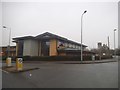
Living in LU6 1UU offers access to essential amenities within walking or short driving distance. Retail options include Co-op Dunstable, Tesco Dunstable High, and Iceland Dunstable, catering to daily needs. Rail links to Leagrave, Harlington, and Luton stations provide easy access to urban centres, supporting both commuting and leisure travel. While the area lacks named parks or leisure facilities in the data, its proximity to retail and transport hubs suggests a practical, convenience-driven lifestyle. The presence of multiple shops and stations indicates a community prioritising accessibility, though residents may need to travel further for specialist services or green spaces.
Amenities
Schools
| Rank | School | Type | Entry gender | Ages |
|---|
Explore more schools in this area
Go to Schools tabDemographics
The community in LU6 1UU is predominantly composed of adults aged 30–64, with a median age of 47. Home ownership stands at 63%, indicating a stable, long-term resident base. The area is largely occupied by houses, reflecting a preference for family-friendly or established living. The predominant ethnic group is White, though no specific data on diversity or deprivation is provided. The high population density—169,305 people per square kilometre—suggests a mix of household types, though specifics on family structures or rental rates are absent. The age profile implies a mature demographic, likely with established careers and family ties, contributing to a steady, low-turnover housing market.
Household Size
Accommodation Type
Tenure
Ethnic Group
Religion
Household Composition
Age
Household Deprivation
NS-SEC
Explore more demographic insights in this area
Go to Demographics tabPlanning
Planning Constraints
- Flood RiskPremium
- Ramsar Wetland SitesPremium
- Area of Outstanding Natural BeautyPremium
- Protected Nature ReservePremium
- Protected WoodlandPremium