Area Overview for LU6 1PE
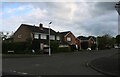
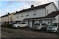
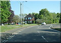
Photos of LU6 1PE


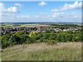


Area Information
Living in LU6 1PE means being part of a small, tightly knit residential cluster in England, where the population of 1,456 residents reflects a quiet, stable community. This area is defined by its compact size and the presence of family-oriented housing, with 93% of homes owned by occupants rather than rented. The median age of 47 suggests a mature demographic, with the majority of residents falling within the 30-64 age range. Daily life here is shaped by proximity to essential services, including retail outlets like Co-op Dunstable and Tesco Dunstable, and easy access to rail networks such as Leagrave and Luton stations. Families benefit from nearby schools, including Lancot School, which operates as both a primary and academy with a good Ofsted rating. The area’s low flood risk and minimal environmental constraints make it a practical choice for those prioritising safety and ease of living. While LU6 1PE is small, its strategic location offers a balance of residential tranquillity and connectivity to broader regional amenities.
- Area Type
- Postcode
- Area Size
- Not available
- Population
- 1456
- Population Density
- 1909 people/km²
The property market in LU6 1PE is characterised by a high rate of home ownership, with 93% of properties owned by residents. This contrasts with areas where rental markets dominate, indicating a community of long-term residents rather than transient tenants. The accommodation type is exclusively houses, which are more common than flats or apartments in this postcode. This makes LU6 1PE a niche area for buyers seeking single-family homes, though the small population size means the housing stock is limited. The lack of flats may appeal to those prioritising space and privacy but could pose challenges for first-time buyers or those seeking smaller properties. Given the area’s compact nature, buyers should consider nearby postcodes for a broader range of options. The high home ownership rate also suggests strong local demand, which may influence property values and availability.
House Prices in LU6 1PE
No properties found in this postcode.
Energy Efficiency in LU6 1PE
The lifestyle in LU6 1PE is shaped by its proximity to retail and transport hubs. Residents have access to five retail outlets within practical reach, including Co-op Dunstable, Iceland Dunstable, and Tesco Dunstable, ensuring everyday shopping needs are met locally. The rail network, with stations like Leagrave and Luton, connects the area to broader regional amenities, making it easy to access dining, leisure, and cultural opportunities beyond the immediate postcode. While the data does not specify parks or recreational spaces, the absence of environmental constraints such as protected woodlands or AONB designations suggests open spaces may be available nearby. The combination of retail convenience and transport links creates a lifestyle that balances local self-sufficiency with the ability to engage with larger urban centres.
Amenities
Schools
Residents of LU6 1PE have access to Lancot School, a primary school, and Lancot School, which operates as an academy with a good Ofsted rating. This dual provision offers families a choice between early years education and a school with a proven track record of performance. The presence of both a primary and academy suggests a focus on consistent educational standards, with the academy likely providing specialist or extended curriculum options. While the data does not specify enrolment numbers or catchment areas, the good rating indicates a school that meets or exceeds national benchmarks. For families prioritising education, this mix of school types provides flexibility, though the small area means competition for places could be keen. The proximity of these schools to residential properties underscores their role as a key draw for families considering LU6 1PE.
| Rank | School | Type | Entry gender | Ages |
|---|
Explore more schools in this area
Go to Schools tabDemographics
The community in LU6 1PE is predominantly composed of adults aged 30-64, with a median age of 47. This suggests a population largely settled into careers and family life, with 93% of homes owned by residents rather than rented out. The accommodation type is exclusively houses, reflecting a lack of flats or shared housing. The predominant ethnic group is White, though specific diversity statistics are not provided. The high home ownership rate indicates long-term residency and stability, which often correlates with community cohesion. With a population of 1,456, the area is small enough to foster familiarity among neighbours but situated in a region with broader retail and transport options. The absence of detailed deprivation data means the quality of life here is inferred from the low crime risk and good school provision. For buyers, this demographic profile suggests a neighbourhood focused on comfort and continuity rather than rapid change.
Household Size
Accommodation Type
Tenure
Ethnic Group
Religion
Household Composition
Age
Household Deprivation
NS-SEC
Explore more demographic insights in this area
Go to Demographics tabPlanning
Planning Constraints
- Flood RiskPremium
- Ramsar Wetland SitesPremium
- Area of Outstanding Natural BeautyPremium
- Protected Nature ReservePremium
- Protected WoodlandPremium