Area Overview for LU6 1FS
Photos of LU6 1FS
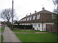
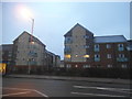
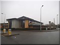
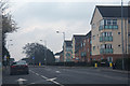
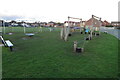

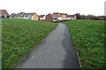
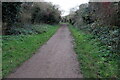

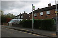
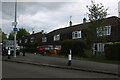
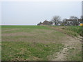
18 photos from this area
Area Information
Key information about the LU6 1FS including its size, population, and administrative classification.
- Area Type
- Postcode
- Area Size
- 1.4 hectares
- Population
- 1681
- Population Density
- 6892 people/km²
House Prices in LU6 1FS
67
Properties
£286,627
Average Sold Price
£57,750
Lowest Price
£440,000
Highest Price
Showing 67 properties
| Address | Type | Beds | Baths | Last Sale Price | Last Sale Date | |
|---|---|---|---|---|---|---|
| 78 Design Drive, Dunstable, LU6 1FS | house | - | - | £440,000 | Jun 2024 | |
| 7 Design Drive, Dunstable, LU6 1FS | Flat | - | - | £82,000 | Mar 2024 | |
| 18 Design Drive, Dunstable, LU6 1FS | Terraced | 4 | 2 | £390,000 | Oct 2023 | |
| 42 Design Drive, Dunstable, LU6 1FS | Flat | 2 | 1 | £214,000 | Oct 2022 | |
| 60 Design Drive, Dunstable, LU6 1FS | Flat | 2 | - | £203,000 | May 2022 | |
| 12 Design Drive, Dunstable, LU6 1FS | Flat | - | - | £200,000 | Jan 2022 | |
| 19 Design Drive, Dunstable, LU6 1FS | Semi-detached | 2 | 1 | £387,500 | Dec 2021 | |
| 32 Design Drive, Dunstable, LU6 1FS | Flat | - | - | £200,000 | Sep 2021 | |
| 20 Design Drive, Dunstable, LU6 1FS | Semi-detached | 4 | 2 | £360,000 | Jun 2021 | |
| 76 Design Drive, Dunstable, LU6 1FS | house | - | - | £392,000 | Jun 2021 |
Page 1 of 7
Energy Efficiency in LU6 1FS
Amenities
Schools
| Rank | School | Type | Entry gender | Ages |
|---|
Explore more schools in this area
Go to Schools tabDemographics
Household Size
Family (3-5 people)
most common
Accommodation Type
Houses
most common
Tenure
89
majority
Ethnic Group
White
most common
Religion
N/A
most common
Household Composition
N/A
most common
Age
47
median
Adults (30-64 years)
most common
Household Deprivation
N/A
with no deprivation
NS-SEC
36
in Lower managerial occupations
Explore more demographic insights in this area
Go to Demographics tabPlanning
Planning Constraints
- Flood RiskPremium
- Ramsar Wetland SitesPremium
- Area of Outstanding Natural BeautyPremium
- Protected Nature ReservePremium
- Protected WoodlandPremium