Area Overview for LU6 1EY
Photos of LU6 1EY


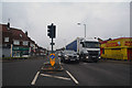
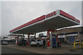
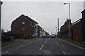
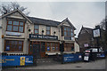


59 photos from this area
Area Information
Key information about the LU6 1EY including its size, population, and administrative classification.
- Area Type
- Postcode
- Area Size
- 7850 m²
- Population
- 2247
- Population Density
- 7237 people/km²
House Prices in LU6 1EY
50
Properties
£164,687
Average Sold Price
£70,000
Lowest Price
£255,000
Highest Price
Showing 50 properties
| Address | Type | Beds | Baths | Last Sale Price | Last Sale Date | |
|---|---|---|---|---|---|---|
| 18 Union Street, Dunstable, LU6 1EY | Maisonette | 2 | 1 | £183,000 | Jan 2024 | |
| 54 Union Street, Dunstable, LU6 1EY | Maisonette | 2 | 1 | £170,000 | May 2022 | |
| 64 Union Street, Dunstable, LU6 1EY | Terraced | 3 | 1 | £255,000 | Oct 2018 | |
| 62 Union Street, Dunstable, LU6 1EY | house | 3 | 1 | £240,000 | Mar 2018 | |
| 54A Union Street, Dunstable, LU6 1EY | Flat | 2 | 1 | £157,000 | Mar 2016 | |
| 60 Union Street, Dunstable, LU6 1EY | house | 2 | - | £142,500 | Jul 2014 | |
| 56 Union Street, Dunstable, LU6 1EY | Maisonette | - | - | £99,995 | Sep 2009 | |
| 70 Union Street, Dunstable, LU6 1EY | Terraced | 3 | 1 | £70,000 | Apr 2001 | |
| Garage 16, Garage Block Dun22, Sandland Close, Dunstable, LU6 1EY | Semi-detached | - | - | - | - | |
| Garage 17, Garage Block Dun22, Sandland Close, Dunstable, LU6 1EY | Detached | - | - | - | - |
Page 1 of 5
Energy Efficiency in LU6 1EY
Amenities
Schools
| Rank | School | Type | Entry gender | Ages |
|---|
Explore more schools in this area
Go to Schools tabDemographics
Household Size
One person
most common
Accommodation Type
Flats
most common
Tenure
48
majority
Ethnic Group
White
most common
Religion
N/A
most common
Household Composition
N/A
most common
Age
47
median
Adults (30-64 years)
most common
Household Deprivation
N/A
with no deprivation
NS-SEC
28
in Lower managerial occupations
Explore more demographic insights in this area
Go to Demographics tabPlanning
Planning Constraints
- Flood RiskPremium
- Ramsar Wetland SitesPremium
- Area of Outstanding Natural BeautyPremium
- Protected Nature ReservePremium
- Protected WoodlandPremium