Area Overview for LU6 1DJ
Photos of LU6 1DJ
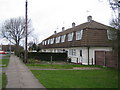
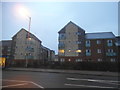
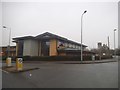
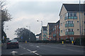
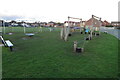

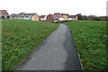
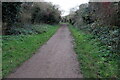

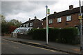
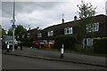
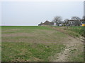
18 photos from this area
Area Information
Key information about the LU6 1DJ including its size, population, and administrative classification.
- Area Type
- Postcode
- Area Size
- 1.4 hectares
- Population
- 1665
- Population Density
- 6033 people/km²
House Prices in LU6 1DJ
39
Properties
£198,888
Average Sold Price
£99,500
Lowest Price
£400,000
Highest Price
Showing 39 properties
| Address | Type | Beds | Baths | Last Sale Price | Last Sale Date | |
|---|---|---|---|---|---|---|
| 102 Westfield Road, Dunstable, LU6 1DJ | house | 4 | 2 | £400,000 | Mar 2025 | |
| 90 Westfield Road, Dunstable, LU6 1DJ | house | - | - | £385,000 | Sep 2021 | |
| 92 Westfield Road, Dunstable, LU6 1DJ | Semi-detached | 2 | 1 | £232,500 | Jul 2019 | |
| 84 Westfield Road, Dunstable, LU6 1DJ | Flat | - | - | £135,000 | Nov 2018 | |
| 86 Westfield Road, Dunstable, LU6 1DJ | Maisonette | 1 | 1 | £125,000 | Nov 2015 | |
| 108 Westfield Road, Dunstable, LU6 1DJ | Semi-detached | 2 | 1 | £139,995 | Nov 2013 | |
| 94 Westfield Road, Dunstable, LU6 1DJ | Semi-detached | 2 | 1 | £168,000 | May 2008 | |
| 128 Westfield Road, Dunstable, LU6 1DJ | Flat | - | - | £105,000 | Mar 2006 | |
| 122 Westfield Road, Dunstable, LU6 1DJ | Flat | 2 | 1 | £99,500 | Dec 2004 | |
| Garage 24, Garage Block Dun26, Westfield Road, Dunstable, LU6 1DJ | Detached | - | - | - | - |
Page 1 of 4
Energy Efficiency in LU6 1DJ
Amenities
Schools
| Rank | School | Type | Entry gender | Ages |
|---|
Explore more schools in this area
Go to Schools tabDemographics
Household Size
Family (3-5 people)
most common
Accommodation Type
Houses
most common
Tenure
52
majority
Ethnic Group
White
most common
Religion
N/A
most common
Household Composition
N/A
most common
Age
47
median
Adults (30-64 years)
most common
Household Deprivation
N/A
with no deprivation
NS-SEC
26
in Lower managerial occupations
Explore more demographic insights in this area
Go to Demographics tabPlanning
Planning Constraints
- Flood RiskPremium
- Ramsar Wetland SitesPremium
- Area of Outstanding Natural BeautyPremium
- Protected Nature ReservePremium
- Protected WoodlandPremium