Area Overview for LU6 1BX
Photos of LU6 1BX
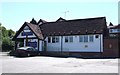
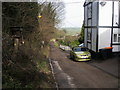
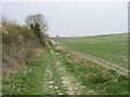
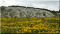

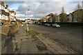
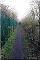
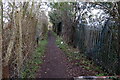
20 photos from this area
Area Information
Key information about the LU6 1BX including its size, population, and administrative classification.
- Area Type
- Postcode
- Area Size
- 7826 m²
- Population
- 1681
- Population Density
- 6892 people/km²
House Prices in LU6 1BX
33
Properties
£195,411
Average Sold Price
£40,000
Lowest Price
£345,000
Highest Price
Showing 33 properties
| Address | Type | Beds | Baths | Last Sale Price | Last Sale Date | |
|---|---|---|---|---|---|---|
| 20 Cheyne Close, Dunstable, LU6 1BX | Terraced | 3 | 1 | £322,000 | Dec 2025 | |
| 38 Cheyne Close, Dunstable, LU6 1BX | Terraced | 3 | 1 | £345,000 | Nov 2024 | |
| 34 Cheyne Close, Dunstable, LU6 1BX | Terraced | 3 | 1 | £300,000 | Mar 2023 | |
| 1 Cheyne Close, Dunstable, LU6 1BX | Terraced | 3 | 1 | £325,000 | Jun 2021 | |
| 4 Cheyne Close, Dunstable, LU6 1BX | house | - | - | £220,000 | Jun 2021 | |
| 26 Cheyne Close, Dunstable, LU6 1BX | Terraced | 3 | 1 | £260,000 | Mar 2021 | |
| 28 Cheyne Close, Dunstable, LU6 1BX | Terraced | 3 | 1 | £255,000 | Mar 2021 | |
| 30 Cheyne Close, Dunstable, LU6 1BX | Terraced | 3 | 1 | £258,000 | Oct 2020 | |
| 11 Cheyne Close, Dunstable, LU6 1BX | Terraced | 3 | 1 | £263,750 | Aug 2020 | |
| 19 Cheyne Close, Dunstable, LU6 1BX | Terraced | 3 | 1 | £253,000 | Aug 2016 |
Page 1 of 4
Energy Efficiency in LU6 1BX
Amenities
Schools
| Rank | School | Type | Entry gender | Ages |
|---|
Explore more schools in this area
Go to Schools tabDemographics
Household Size
Family (3-5 people)
most common
Accommodation Type
Houses
most common
Tenure
89
majority
Ethnic Group
White
most common
Religion
N/A
most common
Household Composition
N/A
most common
Age
47
median
Adults (30-64 years)
most common
Household Deprivation
N/A
with no deprivation
NS-SEC
36
in Lower managerial occupations
Explore more demographic insights in this area
Go to Demographics tabPlanning
Planning Constraints
- Flood RiskPremium
- Ramsar Wetland SitesPremium
- Area of Outstanding Natural BeautyPremium
- Protected Nature ReservePremium
- Protected WoodlandPremium