Area Overview for LU5 6WQ
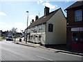
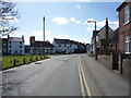
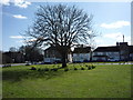
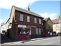
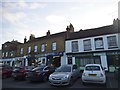
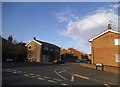
Photos of LU5 6WQ


Area Information
LU5 6WQ is a small, tightly knit residential postcode area in England, home to just 1,699 people. Its compact size means it’s a quiet, community-focused space, where daily life is shaped by proximity to local amenities and transport links. The area’s demographic profile suggests a mature population, with a median age of 47 and a strong presence of adults aged 30–64. This hints at a stable, established community, likely centred around family homes and long-term residency. The low flood risk and absence of protected natural sites indicate a practical, low-maintenance living environment. Residents benefit from nearby rail connections, including Harlington, Flitwick, and Leagrave stations, which provide access to surrounding towns. While the area’s small footprint means limited local shops, nearby retail options like M&S Toddington North and Lidl Houghton are within practical reach. For those prioritising safety, the area’s low crime score of 69/100 offers reassurance. LU5 6WQ is ideal for buyers seeking a peaceful, well-connected home in a setting that balances convenience with tranquillity.
- Area Type
- Postcode
- Area Size
- Not available
- Population
- 1699
- Population Density
- 1727 people/km²
LU5 6WQ is a predominantly owner-occupied area, with 62% of properties owned by residents rather than rented. This suggests a market skewed towards long-term residency and family homes, as the accommodation type is primarily houses. The absence of flats or apartments indicates a focus on traditional, spacious housing, which may appeal to buyers seeking larger living spaces. Given the area’s small size, the housing stock is likely limited, meaning buyers may need to consider nearby postcode areas for more options. The high home ownership rate also implies a stable market with fewer rental properties, which could be advantageous for those seeking a secure investment. However, the limited number of properties may result in a competitive market for buyers. The presence of nearby rail links and retail amenities further enhances the area’s appeal, making it a viable choice for those prioritising convenience and family-friendly living.
House Prices in LU5 6WQ
No properties found in this postcode.
Energy Efficiency in LU5 6WQ
Living in LU5 6WQ offers access to a mix of retail and transport amenities that support a practical lifestyle. Nearby, residents can find M&S Toddington North and South, as well as Lidl Houghton, providing everyday shopping needs within reach. These stores cater to both household essentials and casual dining, contributing to a convenient daily routine. The area’s rail links, including Harlington, Flitwick, and Leagrave stations, offer easy access to broader regional networks, enabling quick travel to nearby towns for work, leisure, or socialising. While the area itself is small, the proximity to these amenities ensures that residents do not feel isolated. The presence of retail and transport hubs suggests a community that balances self-sufficiency with connectivity. For those who enjoy a relaxed pace of life, LU5 6WQ’s amenities provide the essentials without the need for lengthy commutes, enhancing overall quality of life.
Amenities
Schools
| Rank | School | Type | Entry gender | Ages |
|---|
Explore more schools in this area
Go to Schools tabDemographics
The population of LU5 6WQ is 1,699, with a median age of 47. This suggests a mature demographic, dominated by adults aged 30–64, who make up the most common age range. Home ownership is high at 62%, indicating a community of long-term residents rather than transient renters. The area is predominantly composed of houses, not flats, which aligns with the presence of family-oriented living. The predominant ethnic group is White, reflecting a homogenous population. While this data does not explicitly address deprivation levels, the high home ownership and stable age profile suggest a relatively secure socioeconomic environment. The absence of significant diversity metrics implies a community with limited cultural or ethnic variation. For buyers, this profile may appeal to those seeking a stable, low-risk area with a clear identity. However, it also means the area may lack the dynamic diversity found in more cosmopolitan settings.
Household Size
Accommodation Type
Tenure
Ethnic Group
Religion
Household Composition
Age
Household Deprivation
NS-SEC
Explore more demographic insights in this area
Go to Demographics tabPlanning
Planning Constraints
- Flood RiskPremium
- Ramsar Wetland SitesPremium
- Area of Outstanding Natural BeautyPremium
- Protected Nature ReservePremium
- Protected WoodlandPremium