Area Overview for LU5 6QU
Photos of LU5 6QU
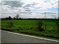
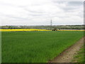
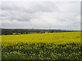

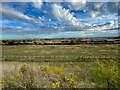


12 photos from this area
Area Information
Key information about the LU5 6QU including its size, population, and administrative classification.
- Area Type
- Postcode
- Area Size
- 1.5 hectares
- Population
- 2386
- Population Density
- 423 people/km²
House Prices in LU5 6QU
49
Properties
£411,485
Average Sold Price
£250,000
Lowest Price
£490,000
Highest Price
Showing 49 properties
| Address | Type | Beds | Baths | Last Sale Price | Last Sale Date | |
|---|---|---|---|---|---|---|
| 81 Morpeth Crescent, Houghton Regis, LU5 6QU | Semi-detached | 4 | 2 | £450,000 | Oct 2025 | |
| 87 Morpeth Crescent, Houghton Regis, LU5 6QU | Flat | 2 | 2 | £250,000 | Mar 2025 | |
| 77 Morpeth Crescent, Houghton Regis, LU5 6QU | Semi-detached | 4 | 2 | £437,500 | Sep 2022 | |
| 71 Morpeth Crescent, Houghton Regis, LU5 6QU | house | - | - | £375,000 | Sep 2022 | |
| 73 Morpeth Crescent, Houghton Regis, LU5 6QU | house | - | - | £390,000 | Sep 2022 | |
| 69 Morpeth Crescent, Houghton Regis, LU5 6QU | house | - | - | £490,000 | Aug 2022 | |
| 67 Morpeth Crescent, Houghton Regis, LU5 6QU | house | - | - | £487,500 | Jun 2022 | |
| 59 Morpeth Crescent, Houghton Regis, LU5 6QU | house | - | - | £407,400 | Jun 2022 | |
| 51 Morpeth Crescent, Houghton Regis, LU5 6QU | house | - | - | £477,000 | Jun 2022 | |
| 53 Morpeth Crescent, Houghton Regis, LU5 6QU | house | - | - | £377,500 | Jun 2022 |
Page 1 of 5
Energy Efficiency in LU5 6QU
Amenities
Schools
| Rank | School | Type | Entry gender | Ages |
|---|
Explore more schools in this area
Go to Schools tabDemographics
Household Size
Family (3-5 people)
most common
Accommodation Type
Houses
most common
Tenure
84
majority
Ethnic Group
White
most common
Religion
N/A
most common
Household Composition
N/A
most common
Age
47
median
Adults (30-64 years)
most common
Household Deprivation
N/A
with no deprivation
NS-SEC
35
in Lower managerial occupations
Explore more demographic insights in this area
Go to Demographics tabPlanning
Planning Constraints
- Flood RiskPremium
- Ramsar Wetland SitesPremium
- Area of Outstanding Natural BeautyPremium
- Protected Nature ReservePremium
- Protected WoodlandPremium