Area Overview for LU5 6HR
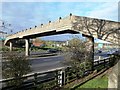
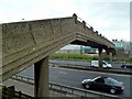
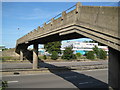
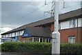
Photos of LU5 6HR


Area Information
LU5 6HR is a small, tightly knit residential postcode area in England, covering just 2.6 hectares and home to 1863 residents. Its compact size means it feels like a quiet, self-contained community, with a population density of 96 people per square kilometre. The area is characterised by its modest scale, offering a blend of suburban calm and practical accessibility. With a median age of 47 and a majority of residents aged between 30 and 64, it is a mature, stable neighbourhood. Most properties are owner-occupied, reflecting a community rooted in long-term residency. Daily life here is shaped by proximity to essential services, including schools, rail links, and retail outlets. While the area lacks major landmarks or sprawling green spaces, its charm lies in its simplicity and the ease of navigating local amenities. For those seeking a quiet, low-maintenance lifestyle with straightforward connectivity, LU5 6HR provides a functional base. Its small footprint means it is not a hub for nightlife or cultural attractions, but it is ideal for those prioritising convenience over urban vibrancy.
- Area Type
- Postcode
- Area Size
- 2.6 hectares
- Population
- 1863
- Population Density
- 96 people/km²
The property market in LU5 6HR is defined by high home ownership (79%) and a predominance of houses over flats. This suggests a community of long-term residents rather than a transient rental market. The small area size of 2.6 hectares means the housing stock is limited, with properties likely to be older and more traditional in design. Buyers should expect a focus on single-family homes, which align with the area’s character. The compact nature of LU5 6HR may limit availability for those seeking larger or newer properties, though the proximity to rail links and amenities could offset this. For those considering the area, the emphasis on owner-occupation implies a stable market, but the small size means competition for available homes could be keen. Potential buyers should also consider the surrounding areas for broader options, though the immediate vicinity is likely to be fully developed.
House Prices in LU5 6HR
Showing 1 properties
| Address | Type | Beds | Baths | Last Sale Price | Last Sale Date | |
|---|---|---|---|---|---|---|
| Marks And Spencer Msa, M 1 Junction 11 To Junction 12, Toddington, LU5 6HR | shop | - | - | - | - |
Energy Efficiency in LU5 6HR
Daily life in LU5 6HR is shaped by its accessible amenities. The five retail outlets, including M&S Toddington North and Lidl Houghton, offer convenience for groceries and essentials. For dining, the area’s small scale means choices are limited, but nearby towns likely provide more options. Rail links to Harlington, Leagrave, and Flitwick stations make it easy to reach larger centres for leisure or shopping. Parks or open spaces are not explicitly mentioned, but the low population density suggests some greenery. The area’s character is defined by its simplicity: a place where practicality outweighs luxury. Residents can enjoy a quiet, low-maintenance lifestyle with straightforward access to services. While it may not cater to those seeking vibrant nightlife, it is ideal for those valuing ease of access to essentials and a manageable commute.
Amenities
Schools
LU5 6HR is served by a mix of primary schools and an academy. Chalton Lower School, a primary school with a good Ofsted rating, provides early education for younger children. Parkfields Middle School operates as both a primary and academy, offering a dual educational pathway. The presence of two primary schools and one academy gives families options, though the small area size means schools are likely to be close to home. The good Ofsted rating at Chalton Lower School indicates a reliable standard of education, while Parkfields’ dual status may offer flexibility in curriculum or governance. However, the absence of secondary schools within the area means students may need to travel to nearby towns for higher education. This mix of school types reflects a balance between traditional and alternative educational models, catering to varied parental preferences.
| Rank | School | Type | Entry gender | Ages |
|---|
Explore more schools in this area
Go to Schools tabDemographics
The population of LU5 6HR is predominantly adults aged 30 to 64, with a median age of 47. This suggests a community of established professionals and families, many of whom may have built their homes over decades. Home ownership is high at 79%, indicating a strong sense of local attachment and stability. The area is composed largely of houses rather than flats, reflecting a preference for traditional, standalone properties. The predominant ethnic group is White, though specific data on diversity is not provided. The population density of 96 people per square kilometre is relatively low, contributing to a less crowded environment. While no deprivation data is available, the high home ownership rate and mature age profile suggest a community with moderate economic security. However, the absence of detailed diversity metrics means the full demographic picture remains partial.
Household Size
Accommodation Type
Tenure
Ethnic Group
Religion
Household Composition
Age
Household Deprivation
NS-SEC
Explore more demographic insights in this area
Go to Demographics tabPlanning
Planning Constraints
- Flood RiskPremium
- Ramsar Wetland SitesPremium
- Area of Outstanding Natural BeautyPremium
- Protected Nature ReservePremium
- Protected WoodlandPremium