Area Overview for LU5 4HT
Photos of LU5 4HT
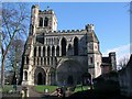
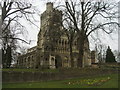


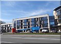
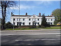
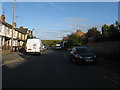
48 photos from this area
Area Information
Key information about the LU5 4HT including its size, population, and administrative classification.
- Area Type
- Postcode
- Area Size
- 3901 m²
- Population
- 1689
- Population Density
- 4820 people/km²
House Prices in LU5 4HT
17
Properties
£195,988
Average Sold Price
£53,500
Lowest Price
£300,000
Highest Price
Showing 17 properties
| Address | Type | Beds | Baths | Last Sale Price | Last Sale Date | |
|---|---|---|---|---|---|---|
| 11 Englands Lane, Dunstable, LU5 4HT | house | - | - | £220,000 | Aug 2025 | |
| 9 Englands Lane, Dunstable, LU5 4HT | Terraced | 2 | 1 | £300,000 | Apr 2025 | |
| 1 Englands Lane, Dunstable, LU5 4HT | Terraced | 2 | 2 | £295,000 | Mar 2025 | |
| 14 Englands Lane, Dunstable, LU5 4HT | Terraced | 2 | 1 | £247,500 | Aug 2023 | |
| 12 Englands Lane, Dunstable, LU5 4HT | Terraced | 2 | 2 | £238,000 | Oct 2019 | |
| 7 Englands Lane, Dunstable, LU5 4HT | Terraced | 2 | 1 | £239,950 | Nov 2018 | |
| 3 Englands Lane, Dunstable, LU5 4HT | house | - | - | £225,000 | Oct 2018 | |
| 18 Englands Lane, Dunstable, LU5 4HT | house | - | - | £178,000 | Jun 2015 | |
| 2 Englands Lane, Dunstable, LU5 4HT | Terraced | 3 | 1 | £190,000 | Oct 2014 | |
| 16 Englands Lane, Dunstable, LU5 4HT | Cottage | 3 | - | £147,000 | May 2014 |
Page 1 of 2
Energy Efficiency in LU5 4HT
Amenities
Schools
| Rank | School | Type | Entry gender | Ages |
|---|
Explore more schools in this area
Go to Schools tabDemographics
Household Size
One person
most common
Accommodation Type
Houses
most common
Tenure
70
majority
Ethnic Group
White
most common
Religion
N/A
most common
Household Composition
N/A
most common
Age
47
median
Adults (30-64 years)
most common
Household Deprivation
N/A
with no deprivation
NS-SEC
31
in Lower managerial occupations
Explore more demographic insights in this area
Go to Demographics tabPlanning
Planning Constraints
- Flood RiskPremium
- Ramsar Wetland SitesPremium
- Area of Outstanding Natural BeautyPremium
- Protected Nature ReservePremium
- Protected WoodlandPremium