Area Overview for LU4 9PU
Photos of LU4 9PU
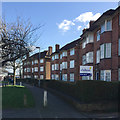
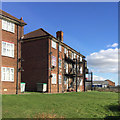
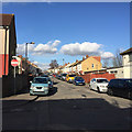
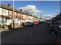

22 photos from this area
Area Information
Key information about the LU4 9PU including its size, population, and administrative classification.
- Area Type
- Postcode
- Area Size
- 2.3 hectares
- Population
- 1991
- Population Density
- 7901 people/km²
House Prices in LU4 9PU
42
Properties
£191,422
Average Sold Price
£21,000
Lowest Price
£415,000
Highest Price
Showing 42 properties
| Address | Type | Beds | Baths | Last Sale Price | Last Sale Date | |
|---|---|---|---|---|---|---|
| 82 Oakley Road, Luton, LU4 9PU | Semi-detached | 3 | - | £415,000 | Apr 2024 | |
| 80 Oakley Road, Luton, LU4 9PU | Semi-detached | 3 | 1 | £356,000 | Feb 2023 | |
| 14 Oakley Road, Luton, LU4 9PU | Detached | 4 | - | £182,000 | Aug 2017 | |
| 86 Oakley Road, Luton, LU4 9PU | Semi-detached | 3 | - | £315,000 | Apr 2017 | |
| 60 Oakley Road, Luton, LU4 9PU | Semi-detached | 3 | 1 | £290,000 | Dec 2015 | |
| 40 Oakley Road, Luton, LU4 9PU | Semi-detached | 3 | - | £268,000 | Jun 2015 | |
| 50 Oakley Road, Luton, LU4 9PU | Bungalow | 3 | - | £245,500 | Feb 2014 | |
| 38 Oakley Road, Luton, LU4 9PU | Semi-detached | 4 | 2 | £230,000 | Dec 2013 | |
| 18 Oakley Road, Luton, LU4 9PU | Bungalow | 2 | - | £158,000 | May 2012 | |
| 6 Oakley Road, Luton, LU4 9PU | Detached | 4 | - | £312,000 | Feb 2011 |
Page 1 of 5
Energy Efficiency in LU4 9PU
Amenities
Schools
| Rank | School | Type | Entry gender | Ages |
|---|
Explore more schools in this area
Go to Schools tabDemographics
Household Size
Family (3-5 people)
most common
Accommodation Type
Houses
most common
Tenure
70
majority
Ethnic Group
asian_total
most common
Religion
N/A
most common
Household Composition
N/A
most common
Age
47
median
Adults (30-64 years)
most common
Household Deprivation
N/A
with no deprivation
NS-SEC
20
in Lower managerial occupations
Explore more demographic insights in this area
Go to Demographics tabPlanning
Planning Constraints
- Flood RiskPremium
- Ramsar Wetland SitesPremium
- Area of Outstanding Natural BeautyPremium
- Protected Nature ReservePremium
- Protected WoodlandPremium