Area Overview for LU4 9GH
Photos of LU4 9GH
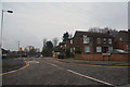

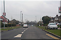
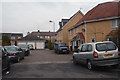

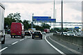
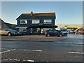
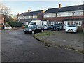
25 photos from this area
Area Information
Key information about the LU4 9GH including its size, population, and administrative classification.
- Area Type
- Postcode
- Area Size
- 1329 m²
- Population
- 2703
- Population Density
- 9228 people/km²
House Prices in LU4 9GH
10
Properties
£196,350
Average Sold Price
£115,000
Lowest Price
£286,000
Highest Price
Showing 10 properties
| Address | Type | Beds | Baths | Last Sale Price | Last Sale Date | |
|---|---|---|---|---|---|---|
| 16 Linden Road, Luton, LU4 9GH | house | - | - | £250,000 | Apr 2022 | |
| 16A Linden Road, Luton, LU4 9GH | Terraced | 2 | 2 | £238,000 | Sep 2021 | |
| 14 Linden Road, Luton, LU4 9GH | Terraced | 3 | 2 | £286,000 | Mar 2021 | |
| 8 Linden Road, Luton, LU4 9GH | Flat | - | - | £168,500 | Feb 2021 | |
| 2 Linden Road, Luton, LU4 9GH | Flat | 2 | 2 | £170,000 | Feb 2019 | |
| 6 Linden Road, Luton, LU4 9GH | Flat | 2 | - | £150,000 | Apr 2016 | |
| 12 Linden Road, Luton, LU4 9GH | Flat | 2 | - | £115,000 | May 2014 | |
| 4 Linden Road, Luton, LU4 9GH | Flat | - | - | £131,750 | Apr 2008 | |
| 18 Linden Road, Luton, LU4 9GH | Detached | 4 | - | £204,250 | Jun 2004 | |
| 10 Linden Road, Luton, LU4 9GH | Flat | 3 | 2 | £250,000 | Dec 2003 |
Energy Efficiency in LU4 9GH
Amenities
Schools
| Rank | School | Type | Entry gender | Ages |
|---|
Explore more schools in this area
Go to Schools tabDemographics
Household Size
Family (3-5 people)
most common
Accommodation Type
Houses
most common
Tenure
57
majority
Ethnic Group
asian_total
most common
Religion
N/A
most common
Household Composition
N/A
most common
Age
47
median
Adults (30-64 years)
most common
Household Deprivation
N/A
with no deprivation
NS-SEC
21
in Lower managerial occupations
Explore more demographic insights in this area
Go to Demographics tabPlanning
Planning Constraints
- Flood RiskPremium
- Ramsar Wetland SitesPremium
- Area of Outstanding Natural BeautyPremium
- Protected Nature ReservePremium
- Protected WoodlandPremium