Area Overview for LU4 9EZ
Photos of LU4 9EZ


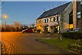
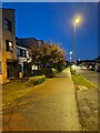
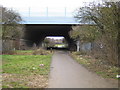

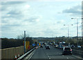
16 photos from this area
Area Information
Key information about the LU4 9EZ including its size, population, and administrative classification.
- Area Type
- Postcode
- Area Size
- 2.6 hectares
- Population
- 1437
- Population Density
- 6105 people/km²
House Prices in LU4 9EZ
62
Properties
£195,628
Average Sold Price
£57,500
Lowest Price
£355,000
Highest Price
Showing 62 properties
| Address | Type | Beds | Baths | Last Sale Price | Last Sale Date | |
|---|---|---|---|---|---|---|
| 24 Hasketon Drive, Luton, LU4 9EZ | Semi-detached | 3 | 1 | £338,000 | Jan 2025 | |
| 57 Hasketon Drive, Luton, LU4 9EZ | Semi-detached | 3 | 1 | £310,000 | Jan 2025 | |
| 28 Hasketon Drive, Luton, LU4 9EZ | Retail | 3 | 1 | £355,000 | Nov 2022 | |
| 8 Hasketon Drive, Luton, LU4 9EZ | house | - | - | £280,000 | May 2022 | |
| 44 Hasketon Drive, Luton, LU4 9EZ | Semi-detached | 3 | 1 | £310,000 | Sep 2021 | |
| 15 Hasketon Drive, Luton, LU4 9EZ | house | - | - | £297,000 | Jul 2021 | |
| 52 Hasketon Drive, Luton, LU4 9EZ | Bungalow | - | - | £264,000 | Jun 2021 | |
| 13 Hasketon Drive, Luton, LU4 9EZ | Semi-detached | 3 | 1 | £240,000 | Aug 2020 | |
| 9 Hasketon Drive, Luton, LU4 9EZ | Semi-detached | 4 | 1 | £337,500 | Jun 2020 | |
| 65 Hasketon Drive, Luton, LU4 9EZ | Semi-detached | 3 | 1 | £260,000 | Dec 2019 |
Page 1 of 7
Energy Efficiency in LU4 9EZ
Amenities
Schools
| Rank | School | Type | Entry gender | Ages |
|---|
Explore more schools in this area
Go to Schools tabDemographics
Household Size
Family (3-5 people)
most common
Accommodation Type
Houses
most common
Tenure
72
majority
Ethnic Group
White
most common
Religion
N/A
most common
Household Composition
N/A
most common
Age
47
median
Adults (30-64 years)
most common
Household Deprivation
N/A
with no deprivation
NS-SEC
22
in Lower managerial occupations
Explore more demographic insights in this area
Go to Demographics tabPlanning
Planning Constraints
- Flood RiskPremium
- Ramsar Wetland SitesPremium
- Area of Outstanding Natural BeautyPremium
- Protected Nature ReservePremium
- Protected WoodlandPremium