Area Overview for LU4 8HH
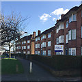
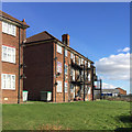
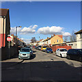
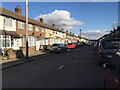
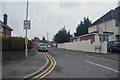
Photos of LU4 8HH


Area Information
LU4 8HH is a small residential postcode area in England, home to around 2,200 people. It is a compact cluster of properties, likely centred on a local hub with a mix of housing types. The area’s character is defined by its proximity to key transport links and amenities, making it accessible for both commuters and those seeking convenience. With a median age of 22, the population includes a notable proportion of adults aged 30–64, suggesting a blend of young professionals and families. The predominantly Asian community contributes to the area’s cultural dynamics, though specific diversity metrics are not detailed. Daily life here is shaped by the availability of nearby schools, retail outlets, and rail connections, offering a balance between suburban tranquillity and urban accessibility. The low flood risk and crime score of 78 further enhance its appeal as a safe, stable place to live. For those seeking a small, connected community with practical amenities, LU4 8HH provides a straightforward option.
- Area Type
- Postcode
- Area Size
- Not available
- Population
- 2204
- Population Density
- 9857 people/km²
The property market in LU4 8HH is characterised by a 63% home ownership rate, indicating that nearly two-thirds of residents live in owner-occupied properties. The accommodation type is primarily houses, which suggests a focus on family homes rather than apartments or flats. This mix implies a market that caters to both long-term residents and those seeking stability in a small, defined area. Given the postcode’s small size, the housing stock is likely limited, which could mean higher competition for available properties. The presence of rail links and nearby schools may further drive demand, particularly from families. Buyers should consider that the area’s compact nature means proximity to amenities is a key selling point. However, the lack of specific price data means assessments of value must rely on broader regional trends. For those prioritising a family-friendly, low-risk environment, LU4 8HH’s property market offers a blend of practicality and security.
House Prices in LU4 8HH
No properties found in this postcode.
Energy Efficiency in LU4 8HH
Living in LU4 8HH offers access to a range of practical amenities within easy reach. The area is near five retail outlets, including Lidl Hatters, Aldi Bury, and Asda Empire, providing everyday shopping options. Rail stations such as Leagrave and Luton Airport Parkway offer convenient links to nearby towns and the London Luton Airport, enhancing travel flexibility. While the data does not mention parks or leisure facilities, the presence of multiple retail and transport hubs suggests a lifestyle focused on convenience and accessibility. The small size of the area means amenities are closely clustered, reducing the need for long commutes. For residents prioritising practicality over sprawling green spaces, LU4 8HH delivers a compact, service-rich environment. The combination of retail, rail, and air travel options ensures daily life is efficient, though further exploration of recreational areas would be needed for a more rounded assessment.
Amenities
Schools
Residents of LU4 8HH have access to two primary schools: Downside Junior School and Downside Primary School, both of which are rated ‘good’ by Ofsted. These institutions cater to younger children, providing a foundation for education within the community. The presence of two primary schools suggests a focus on early education, which is particularly beneficial for families with young children. The ‘good’ Ofsted rating indicates that these schools meet national standards in teaching quality and student outcomes. While no secondary schools are listed, the proximity to rail links may facilitate access to larger educational institutions in nearby towns. For parents prioritising strong local schooling, LU4 8HH offers a reliable start to a child’s education, though further research into secondary options would be necessary for long-term planning.
| Rank | School | Type | Entry gender | Ages |
|---|
Explore more schools in this area
Go to Schools tabDemographics
The population of LU4 8HH is 2,204, with a median age of 22. This contrasts with the most common age range of 30–64 years, indicating a community where younger residents coexist with a larger proportion of middle-aged adults. Home ownership rates are 63%, suggesting a mix of owner-occupied properties and rental homes. The accommodation type is predominantly houses, which may reflect a family-oriented demographic. The predominant ethnic group is listed as Asian_total, though no further breakdown of diversity is provided. This composition implies a stable, possibly multi-generational community, with a focus on residential permanence. The lower median age may hint at younger professionals or students, but the majority of residents fall into the working-age bracket, which could influence local services and amenities. The absence of specific deprivation data means quality of life is inferred from safety and infrastructure metrics, which are generally positive.
Household Size
Accommodation Type
Tenure
Ethnic Group
Religion
Household Composition
Age
Household Deprivation
NS-SEC
Explore more demographic insights in this area
Go to Demographics tabPlanning
Planning Constraints
- Flood RiskPremium
- Ramsar Wetland SitesPremium
- Area of Outstanding Natural BeautyPremium
- Protected Nature ReservePremium
- Protected WoodlandPremium