Area Overview for LU4 8AG
Photos of LU4 8AG
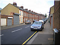

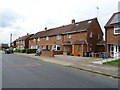
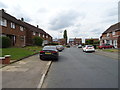
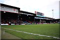
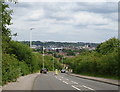
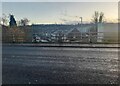
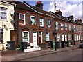
16 photos from this area
Area Information
Key information about the LU4 8AG including its size, population, and administrative classification.
- Area Type
- Postcode
- Area Size
- 1.1 hectares
- Population
- 1823
- Population Density
- 14845 people/km²
House Prices in LU4 8AG
60
Properties
£117,515
Average Sold Price
£23,000
Lowest Price
£270,000
Highest Price
Showing 60 properties
| Address | Type | Beds | Baths | Last Sale Price | Last Sale Date | |
|---|---|---|---|---|---|---|
| 28 Ash Road, Luton, LU4 8AG | Terraced | 3 | 1 | £270,000 | May 2024 | |
| 22 Ash Road, Luton, LU4 8AG | Terraced | 3 | 1 | £260,000 | Feb 2024 | |
| 59 Ash Road, Luton, LU4 8AG | house | 2 | - | £175,000 | Feb 2023 | |
| 47 Ash Road, Luton, LU4 8AG | house | - | - | £240,000 | Jun 2021 | |
| 10 Ash Road, Luton, LU4 8AG | house | - | - | £230,000 | Dec 2020 | |
| 6 Ash Road, Luton, LU4 8AG | Terraced | 3 | 1 | £245,000 | Sep 2020 | |
| 29 Ash Road, Luton, LU4 8AG | Terraced | 3 | 1 | £252,000 | Oct 2018 | |
| 15 Ash Road, Luton, LU4 8AG | Terraced | 3 | 1 | £200,000 | Mar 2018 | |
| 37 Ash Road, Luton, LU4 8AG | Terraced | 3 | 1 | £170,000 | Nov 2015 | |
| 36 Ash Road, Luton, LU4 8AG | house | - | - | £125,000 | Feb 2015 |
Page 1 of 6
Energy Efficiency in LU4 8AG
Amenities
Schools
| Rank | School | Type | Entry gender | Ages |
|---|
Explore more schools in this area
Go to Schools tabDemographics
Household Size
Family (3-5 people)
most common
Accommodation Type
Houses
most common
Tenure
36
majority
Ethnic Group
asian_total
most common
Religion
N/A
most common
Household Composition
N/A
most common
Age
22
median
Adults (30-64 years)
most common
Household Deprivation
N/A
with no deprivation
NS-SEC
10
in Lower managerial occupations
Explore more demographic insights in this area
Go to Demographics tabPlanning
Planning Constraints
- Flood RiskPremium
- Ramsar Wetland SitesPremium
- Area of Outstanding Natural BeautyPremium
- Protected Nature ReservePremium
- Protected WoodlandPremium