Area Overview for LU4 8AB
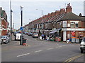
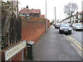
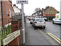
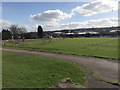
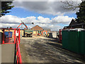
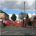
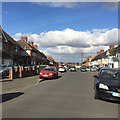
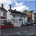
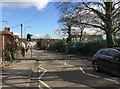
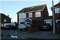
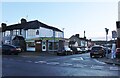
Photos of LU4 8AB

Area Information
LU4 8AB is a small residential postcode area in England, home to around 2,173 people. It sits within a compact cluster of housing, offering a quiet but connected lifestyle. The area’s proximity to Luton and its surrounding infrastructure makes it a practical choice for those seeking a balance between suburban comfort and urban accessibility. Daily life here is shaped by its location near key transport hubs, including multiple railway stations and London Luton Airport, which provide easy access to regional and national travel. The community is predominantly composed of adults aged 30–64, with a median age of 22, suggesting a mix of young professionals and established families. While the area is small, it benefits from low flood risk and no major environmental constraints, making it a stable place to live. Its appeal lies in its straightforward living conditions, practical amenities, and straightforward connectivity, ideal for those prioritising reliability over sprawling urban vibrancy.
- Area Type
- Postcode
- Area Size
- Not available
- Population
- 2173
- Population Density
- 5194 people/km²
The property market in LU4 8AB is characterised by a 59% home ownership rate, indicating that nearly six in ten properties are owner-occupied. The area is predominantly composed of houses, which contrasts with regions where flats or apartments dominate. This suggests a housing stock that caters to families or individuals seeking more space and privacy. Given the small size of the postcode area, the available housing is likely limited to a handful of properties, making it a niche market for buyers. The presence of houses may appeal to those prioritising traditional family homes over modern developments. However, the limited scale of the area means that buyers should consider nearby regions for a broader selection. The market’s stability is reinforced by the absence of environmental constraints, though the moderate home ownership rate hints at a mix of long-term residents and renters.
House Prices in LU4 8AB
No properties found in this postcode.
Energy Efficiency in LU4 8AB
Living in LU4 8AB provides access to a range of practical amenities within short distances. Retail options include Spar, Tesco Luton, and Asda Empire, offering everyday shopping needs. The area’s rail network is extensive, with stations like Leagrave and Luton Airport Parkway facilitating easy travel to London and beyond. London Luton Airport is a major draw, providing direct flights and connecting residents to national and international destinations. While the area lacks large parks or leisure facilities, its proximity to Luton ensures that residents can access cultural and recreational opportunities in the town centre. The presence of multiple retail and transport hubs contributes to a convenient, functional lifestyle, particularly for those prioritising accessibility over expansive green spaces. The small scale of the area means that amenities are concentrated, requiring minimal travel for essential services.
Amenities
Schools
| Rank | School | Type | Entry gender | Ages |
|---|
Explore more schools in this area
Go to Schools tabDemographics
The population of LU4 8AB is 2,173, with a median age of 22, though the most common age group is adults aged 30–64. This suggests a community with a mix of younger residents and middle-aged individuals, possibly reflecting a blend of student populations and working-age households. Home ownership in the area stands at 59%, indicating a moderate balance between owner-occupied properties and rental stock. The predominant accommodation type is houses, which aligns with the area’s residential character. The dominant ethnic group is Asian_total, highlighting the cultural diversity of the neighbourhood. While no specific deprivation data is provided, the high home ownership rate and presence of family-oriented housing suggest a stable economic profile. The area’s demographics reflect a practical, community-focused environment where households are likely to prioritise long-term stability and proximity to essential services.
Household Size
Accommodation Type
Tenure
Ethnic Group
Religion
Household Composition
Age
Household Deprivation
NS-SEC
Explore more demographic insights in this area
Go to Demographics tabPlanning
Planning Constraints
- Flood RiskPremium
- Ramsar Wetland SitesPremium
- Area of Outstanding Natural BeautyPremium
- Protected Nature ReservePremium
- Protected WoodlandPremium