Area Overview for LU4 0ZU
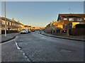
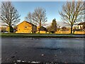
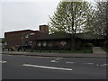
Photos of LU4 0ZU


Area Information
LU4 0ZU is a small, tightly knit residential postcode in England, home to 1,468 people. This area is characterised by its quiet, mature community, with a median age of 47 and a population skewed toward adults aged 30–64. The cluster of homes here suggests a focus on stability, with 39% of properties owned by residents and the rest likely rented. Daily life is shaped by proximity to schools, rail links, and retail, making it a practical choice for families and commuters. The area’s compact size means amenities are within walking or short driving distance, though it lacks the density of larger urban centres. Its location near Luton and nearby airports offers easy access to regional hubs without the congestion of bigger cities. For those seeking a balanced lifestyle with access to essential services, LU4 0ZU provides a mix of convenience and tranquillity.
- Area Type
- Postcode
- Area Size
- Not available
- Population
- 1468
- Population Density
- 4510 people/km²
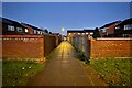
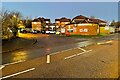
The property market in LU4 0ZU is defined by its low home ownership rate of 39%, indicating that a significant proportion of properties are likely rented. The accommodation type is predominantly houses, which suggests a suburban or semi-rural layout with larger, standalone homes rather than high-density housing. This makes the area more appealing to families or individuals seeking space, though the small size of the postcode means the housing stock is limited. The focus on owner-occupied properties is not dominant, so buyers may find a mix of rental and purchase opportunities. For those considering this area, the limited number of homes means competition could be fierce, particularly for properties with desirable features. The presence of nearby rail links and schools adds to the area’s appeal, though its small size means buyers must look beyond LU4 0ZU for broader options.
House Prices in LU4 0ZU
No properties found in this postcode.
Energy Efficiency in LU4 0ZU
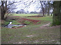
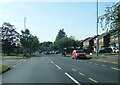
The lifestyle in LU4 0ZU is shaped by its proximity to essential amenities. Retail options include Morrisons Daily, Co-op Lewsey, and other local shops, providing convenience for daily errands. The area’s rail stations offer easy access to Luton and beyond, while the nearby London Luton Airport caters to travel needs. Though the data does not mention parks or leisure facilities, the absence of planning constraints like AONB or protected woodlands suggests open spaces may be available. The mix of retail, transport, and educational institutions creates a functional environment for families and commuters. The small size of the postcode means amenities are within practical reach, though the area’s character is defined more by its practicality than by extensive leisure options.
Amenities
Schools
LU4 0ZU is served by a range of primary and nursery schools, including Pastures Way Nursery School, Southfield Primary School, Southfield Infant School, St Martin de Porres Primary School, and St Martin De Porres RC VA Infant School. These institutions cater to early years education and primary schooling, offering families multiple options for their children’s education. The presence of both infant and primary schools suggests a well-rounded educational infrastructure, though no Ofsted ratings are provided in the data. The mix of state and Catholic schools indicates a diversity of educational philosophies, allowing parents to choose between secular and faith-based environments. For families prioritising proximity to schools, LU4 0ZU’s cluster of educational institutions is a key advantage, though the area’s small size means school catchment areas may be limited.
| Rank | School | Type | Entry gender | Ages |
|---|
Explore more schools in this area
Go to Schools tabDemographics
The population of LU4 0ZU is predominantly adults aged 30–64, with a median age of 47, indicating a mature, established community. Home ownership here stands at 39%, suggesting a mix of owner-occupied properties and rentals. The area is composed mainly of houses, reflecting a suburban or semi-rural character. The predominant ethnic group is White, though no further breakdown of diversity is provided. The absence of specific deprivation data means the area’s socioeconomic profile remains unquantified, but the demographic stability suggests a low turnover of residents. This makes LU4 0ZU a place where long-term residents may be more common than transient populations. The age profile and housing stock imply a community focused on family life and long-term residency, with limited data on younger or older demographics.
Household Size
Accommodation Type
Tenure
Ethnic Group
Religion
Household Composition
Age
Household Deprivation
NS-SEC
Explore more demographic insights in this area
Go to Demographics tabPlanning
Planning Constraints
- Flood RiskPremium
- Ramsar Wetland SitesPremium
- Area of Outstanding Natural BeautyPremium
- Protected Nature ReservePremium
- Protected WoodlandPremium