Area Overview for LU4 0YN
Photos of LU4 0YN
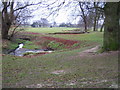
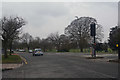
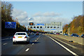
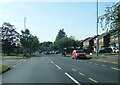


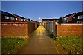
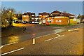
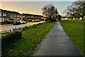
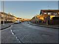
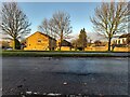
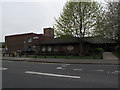
24 photos from this area
Area Information
Key information about the LU4 0YN including its size, population, and administrative classification.
- Area Type
- Postcode
- Area Size
- 1.0 hectares
- Population
- 1585
- Population Density
- 4076 people/km²
House Prices in LU4 0YN
41
Properties
£199,111
Average Sold Price
£85,000
Lowest Price
£321,000
Highest Price
Showing 41 properties
| Address | Type | Beds | Baths | Last Sale Price | Last Sale Date | |
|---|---|---|---|---|---|---|
| 11 Holkham Close, Luton, LU4 0YN | Terraced | 3 | 1 | £321,000 | Sep 2023 | |
| 18 Holkham Close, Luton, LU4 0YN | Semi-detached | 3 | 2 | £275,000 | Aug 2020 | |
| 4 Holkham Close, Luton, LU4 0YN | house | - | - | £225,000 | Feb 2017 | |
| 16 Holkham Close, Luton, LU4 0YN | house | - | - | £215,000 | Jun 2016 | |
| 31 Holkham Close, Luton, LU4 0YN | Semi-detached | 3 | 1 | £230,000 | Jun 2016 | |
| 30 Holkham Close, Luton, LU4 0YN | Terraced | - | - | £176,000 | Jun 2015 | |
| 34 Holkham Close, Luton, LU4 0YN | Terraced | - | - | £130,000 | May 2006 | |
| 25 Holkham Close, Luton, LU4 0YN | Terraced | 3 | - | £135,000 | Mar 2006 | |
| 32 Holkham Close, Luton, LU4 0YN | house | - | - | £85,000 | Apr 2000 | |
| 21 Holkham Close, Luton, LU4 0YN | Terraced | 3 | 2 | - | - |
Page 1 of 5
Energy Efficiency in LU4 0YN
Amenities
Schools
| Rank | School | Type | Entry gender | Ages |
|---|
Explore more schools in this area
Go to Schools tabDemographics
Household Size
Family (3-5 people)
most common
Accommodation Type
Houses
most common
Tenure
55
majority
Ethnic Group
White
most common
Religion
N/A
most common
Household Composition
N/A
most common
Age
47
median
Adults (30-64 years)
most common
Household Deprivation
N/A
with no deprivation
NS-SEC
26
in Lower managerial occupations
Explore more demographic insights in this area
Go to Demographics tabPlanning
Planning Constraints
- Flood RiskPremium
- Ramsar Wetland SitesPremium
- Area of Outstanding Natural BeautyPremium
- Protected Nature ReservePremium
- Protected WoodlandPremium