Area Overview for LU4 0XA
Photos of LU4 0XA
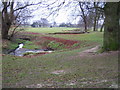
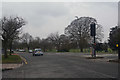
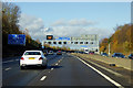
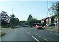


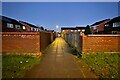
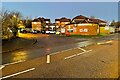
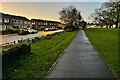
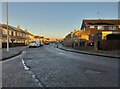
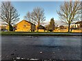
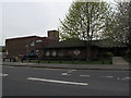
24 photos from this area
Area Information
Key information about the LU4 0XA including its size, population, and administrative classification.
- Area Type
- Postcode
- Area Size
- 1.9 hectares
- Population
- 1468
- Population Density
- 4510 people/km²
House Prices in LU4 0XA
19
Properties
£202,885
Average Sold Price
£56,500
Lowest Price
£340,000
Highest Price
Showing 19 properties
| Address | Type | Beds | Baths | Last Sale Price | Last Sale Date | |
|---|---|---|---|---|---|---|
| 9 Holgate Drive, Luton, LU4 0XA | Semi-detached | 3 | 1 | £315,000 | Jul 2024 | |
| 7 Holgate Drive, Luton, LU4 0XA | Semi-detached | - | - | £250,000 | Nov 2022 | |
| 33 Holgate Drive, Luton, LU4 0XA | house | - | - | £340,000 | May 2022 | |
| 5 Holgate Drive, Luton, LU4 0XA | house | - | - | £330,000 | Aug 2021 | |
| 35 Holgate Drive, Luton, LU4 0XA | Semi-detached | 3 | 1 | £260,000 | Jan 2020 | |
| 31 Holgate Drive, Luton, LU4 0XA | house | - | - | £200,000 | Jun 2015 | |
| 15 Holgate Drive, Luton, LU4 0XA | Bungalow | - | - | £190,000 | Jan 2013 | |
| 25 Holgate Drive, Luton, LU4 0XA | house | 4 | - | £176,500 | Feb 2008 | |
| 27 Holgate Drive, Luton, LU4 0XA | Terraced | - | - | £144,500 | Sep 2004 | |
| 29 Holgate Drive, Luton, LU4 0XA | Terraced | - | - | £166,000 | Aug 2003 |
Page 1 of 2
Energy Efficiency in LU4 0XA
Amenities
Schools
| Rank | School | Type | Entry gender | Ages |
|---|
Explore more schools in this area
Go to Schools tabDemographics
Household Size
One person
most common
Accommodation Type
Houses
most common
Tenure
39
majority
Ethnic Group
White
most common
Religion
N/A
most common
Household Composition
N/A
most common
Age
47
median
Adults (30-64 years)
most common
Household Deprivation
N/A
with no deprivation
NS-SEC
20
in Lower managerial occupations
Explore more demographic insights in this area
Go to Demographics tabPlanning
Planning Constraints
- Flood RiskPremium
- Ramsar Wetland SitesPremium
- Area of Outstanding Natural BeautyPremium
- Protected Nature ReservePremium
- Protected WoodlandPremium