Area Overview for LU4 0LY
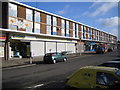
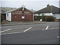
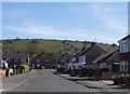
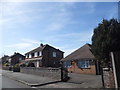
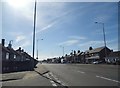
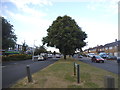
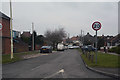
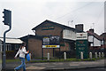
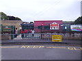
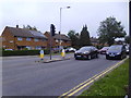
Photos of LU4 0LY


Area Information
LU4 0LY is a small residential postcode in England, home to around 1,640 people. This compact area is characterised by its cluster of homes, offering a quiet, community-oriented environment. The population is predominantly adults aged 30–64, with a median age of 47, suggesting a stable, mature demographic. Living here means access to practical amenities within reach, including multiple retail outlets, rail stations, and proximity to London Luton Airport. The area’s low crime risk and absence of environmental constraints like protected woodlands or wetlands make it a straightforward, low-stress place to live. While it lacks the density of larger towns, its small size ensures a close-knit feel, with homes primarily owned by residents rather than rented out. For those prioritising safety, connectivity, and ease of access to transport, LU4 0LY offers a straightforward, functional lifestyle without the complexities of urban living.
- Area Type
- Postcode
- Area Size
- Not available
- Population
- 1640
- Population Density
- 6384 people/km²
The property market in LU4 0LY is dominated by owner-occupied homes, with 75% of properties owned by their occupants. This suggests a community of long-term residents rather than a rental-heavy market. The accommodation type is primarily houses, which is typical for smaller, residential postcode areas. Given the small population of 1,640, the housing stock is likely limited in scale, with homes clustered closely together. Buyers considering this area should note that the market is not driven by high demand or speculative investment, but by the practical needs of local residents. The proximity to rail stations and airports may enhance the area’s appeal for commuters or those requiring transport links, though the small size of LU4 0LY means property choices are constrained. For those seeking a quiet, stable home with minimal environmental or planning constraints, this area offers a straightforward, low-maintenance option.
House Prices in LU4 0LY
No properties found in this postcode.
Energy Efficiency in LU4 0LY
Living in LU4 0LY offers access to a range of practical amenities within a short distance. Retail options include major chains such as Tesco Dunstable, Co-op Dunstable, and Morrisons Daily, providing everyday shopping needs. The area’s rail stations—Leagrave, Luton, and Luton Airport Parkway—offer easy access to commuting routes and regional travel, while proximity to London Luton Airport makes air travel straightforward. Though the area is small, these amenities collectively support a functional lifestyle, with minimal need to travel far for essentials. The absence of large parks or leisure facilities means the character of daily life is more subdued, focused on convenience and practicality. For those prioritising accessibility over expansive recreational spaces, LU4 0LY delivers a streamlined, no-frills approach to living.
Amenities
Schools
| Rank | School | Type | Entry gender | Ages |
|---|
Explore more schools in this area
Go to Schools tabDemographics
The community in LU4 0LY is largely composed of adults aged 30–64, with a median age of 47. This suggests a population that is largely established in careers and family life, with fewer young families or retirees compared to other areas. Home ownership is high at 75%, indicating a strong presence of long-term residents. The accommodation is predominantly houses, which aligns with the area’s residential character. The predominant ethnic group is White, reflecting a relatively homogeneous demographic profile. While no specific data on deprivation is provided, the high home ownership rate and low crime risk suggest a stable, middle-income community with reasonable access to services. The absence of detailed diversity statistics means the area’s cultural makeup remains less defined, but its demographic consistency likely contributes to a cohesive, familiar environment for residents.
Household Size
Accommodation Type
Tenure
Ethnic Group
Religion
Household Composition
Age
Household Deprivation
NS-SEC
Explore more demographic insights in this area
Go to Demographics tabPlanning
Planning Constraints
- Flood RiskPremium
- Ramsar Wetland SitesPremium
- Area of Outstanding Natural BeautyPremium
- Protected Nature ReservePremium
- Protected WoodlandPremium