Area Overview for LU4 0LD
Photos of LU4 0LD
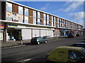
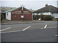
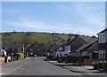
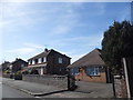
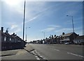
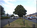

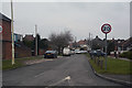

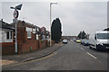
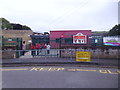
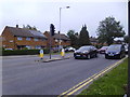
25 photos from this area
Area Information
Key information about the LU4 0LD including its size, population, and administrative classification.
- Area Type
- Postcode
- Area Size
- 1.4 hectares
- Population
- 1829
- Population Density
- 6264 people/km²
House Prices in LU4 0LD
30
Properties
£187,667
Average Sold Price
£37,000
Lowest Price
£365,000
Highest Price
Showing 30 properties
| Address | Type | Beds | Baths | Last Sale Price | Last Sale Date | |
|---|---|---|---|---|---|---|
| 218 Poynters Road, Luton, LU4 0LD | Terraced | 2 | 1 | £270,000 | Jan 2025 | |
| 236 Poynters Road, Luton, LU4 0LD | Semi-detached | 3 | 1 | £350,000 | Feb 2024 | |
| 198 Poynters Road, Luton, LU4 0LD | Terraced | 3 | 1 | £315,000 | Aug 2023 | |
| 208 Poynters Road, Luton, LU4 0LD | Retail | 3 | 1 | £365,000 | Oct 2022 | |
| 226 Poynters Road, Luton, LU4 0LD | Semi-detached | 3 | 1 | £230,000 | Jul 2020 | |
| 196 Poynters Road, Luton, LU4 0LD | Terraced | 3 | 1 | £210,000 | Jun 2019 | |
| 242 Poynters Road, Luton, LU4 0LD | house | - | - | £243,000 | Feb 2019 | |
| 240 Poynters Road, Luton, LU4 0LD | house | - | - | £172,000 | Oct 2014 | |
| 190 Poynters Road, Luton, LU4 0LD | Terraced | 3 | 1 | £185,000 | May 2014 | |
| 192 Poynters Road, Luton, LU4 0LD | Terraced | 3 | 1 | £125,000 | Mar 2012 |
Page 1 of 3
Energy Efficiency in LU4 0LD
Amenities
Schools
| Rank | School | Type | Entry gender | Ages |
|---|
Explore more schools in this area
Go to Schools tabDemographics
Household Size
Family (3-5 people)
most common
Accommodation Type
Houses
most common
Tenure
59
majority
Ethnic Group
White
most common
Religion
N/A
most common
Household Composition
N/A
most common
Age
47
median
Adults (30-64 years)
most common
Household Deprivation
N/A
with no deprivation
NS-SEC
20
in Lower managerial occupations
Explore more demographic insights in this area
Go to Demographics tabPlanning
Planning Constraints
- Flood RiskPremium
- Ramsar Wetland SitesPremium
- Area of Outstanding Natural BeautyPremium
- Protected Nature ReservePremium
- Protected WoodlandPremium