Area Overview for LU4 0DH
Photos of LU4 0DH
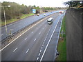
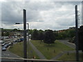
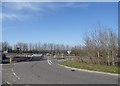
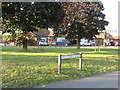


39 photos from this area
Area Information
Key information about the LU4 0DH including its size, population, and administrative classification.
- Area Type
- Postcode
- Area Size
- 2.2 hectares
- Population
- 1992
- Population Density
- 5088 people/km²
House Prices in LU4 0DH
25
Properties
£278,777
Average Sold Price
£70,000
Lowest Price
£560,000
Highest Price
Showing 25 properties
| Address | Type | Beds | Baths | Last Sale Price | Last Sale Date | |
|---|---|---|---|---|---|---|
| 18 Derby Road, Luton, LU4 0DH | Bungalow | 5 | 3 | £400,000 | Sep 2023 | |
| 21 Derby Road, Luton, LU4 0DH | Detached | 1 | 1 | £560,000 | Nov 2022 | |
| 10 Derby Road, Luton, LU4 0DH | house | - | - | £495,000 | Feb 2022 | |
| 23 Derby Road, Luton, LU4 0DH | Bungalow | 3 | 1 | £345,000 | Sep 2020 | |
| 12 Derby Road, Luton, LU4 0DH | Detached | 3 | 1 | £334,995 | Feb 2016 | |
| 22 Derby Road, Luton, LU4 0DH | Bungalow | 4 | 1 | £236,000 | Oct 2014 | |
| 7 Derby Road, Luton, LU4 0DH | Bungalow | 3 | 2 | £227,000 | Aug 2014 | |
| 24 Derby Road, Luton, LU4 0DH | house | - | - | £275,000 | Dec 2012 | |
| 16 Derby Road, Luton, LU4 0DH | Flat | - | 1 | £325,000 | Nov 2011 | |
| 13 Derby Road, Luton, LU4 0DH | Bungalow | - | - | £175,000 | Aug 2009 |
Page 1 of 3
Energy Efficiency in LU4 0DH
Amenities
Schools
| Rank | School | Type | Entry gender | Ages |
|---|
Explore more schools in this area
Go to Schools tabDemographics
Household Size
Family (3-5 people)
most common
Accommodation Type
Houses
most common
Tenure
60
majority
Ethnic Group
asian_total
most common
Religion
N/A
most common
Household Composition
N/A
most common
Age
47
median
Adults (30-64 years)
most common
Household Deprivation
N/A
with no deprivation
NS-SEC
30
in Lower managerial occupations
Explore more demographic insights in this area
Go to Demographics tabPlanning
Planning Constraints
- Flood RiskPremium
- Ramsar Wetland SitesPremium
- Area of Outstanding Natural BeautyPremium
- Protected Nature ReservePremium
- Protected WoodlandPremium