Area Overview for LU3 4EE
Photos of LU3 4EE
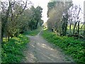
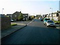
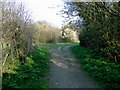
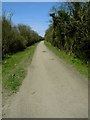
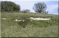

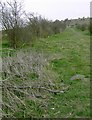
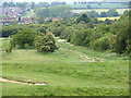
21 photos from this area
Area Information
Key information about the LU3 4EE including its size, population, and administrative classification.
- Area Type
- Postcode
- Area Size
- 8298 m²
- Population
- 1486
- Population Density
- 3755 people/km²
House Prices in LU3 4EE
39
Properties
£164,868
Average Sold Price
£55,500
Lowest Price
£335,000
Highest Price
Showing 39 properties
| Address | Type | Beds | Baths | Last Sale Price | Last Sale Date | |
|---|---|---|---|---|---|---|
| 17 Farrow Close, Luton, LU3 4EE | Terraced | 1 | 1 | £195,000 | Aug 2025 | |
| 29 Farrow Close, Luton, LU3 4EE | Terraced | 2 | 1 | £275,000 | Feb 2025 | |
| 11 Farrow Close, Luton, LU3 4EE | Terraced | 3 | 1 | £335,000 | May 2024 | |
| 3 Farrow Close, Luton, LU3 4EE | Terraced | 2 | 1 | £270,000 | Oct 2023 | |
| 23 Farrow Close, Luton, LU3 4EE | house | 1 | 1 | £180,000 | Jul 2023 | |
| 28 Farrow Close, Luton, LU3 4EE | Retail | 1 | 1 | £180,000 | Oct 2022 | |
| 24 Farrow Close, Luton, LU3 4EE | house | - | - | £295,000 | Jul 2022 | |
| 36 Farrow Close, Luton, LU3 4EE | house | - | - | £200,000 | May 2021 | |
| 39 Farrow Close, Luton, LU3 4EE | house | - | - | £280,000 | Apr 2021 | |
| 19 Farrow Close, Luton, LU3 4EE | house | - | - | £175,000 | Dec 2020 |
Page 1 of 4
Energy Efficiency in LU3 4EE
Amenities
Schools
| Rank | School | Type | Entry gender | Ages |
|---|
Explore more schools in this area
Go to Schools tabDemographics
Household Size
Family (3-5 people)
most common
Accommodation Type
Houses
most common
Tenure
81
majority
Ethnic Group
White
most common
Religion
N/A
most common
Household Composition
N/A
most common
Age
47
median
Adults (30-64 years)
most common
Household Deprivation
N/A
with no deprivation
NS-SEC
36
in Lower managerial occupations
Explore more demographic insights in this area
Go to Demographics tabPlanning
Planning Constraints
- Flood RiskPremium
- Ramsar Wetland SitesPremium
- Area of Outstanding Natural BeautyPremium
- Protected Nature ReservePremium
- Protected WoodlandPremium