Area Overview for LU3 3UG
Photos of LU3 3UG
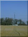
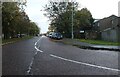
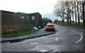
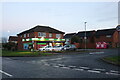
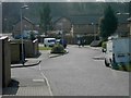

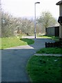
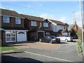
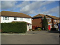
10 photos from this area
Area Information
Key information about the LU3 3UG including its size, population, and administrative classification.
- Area Type
- Postcode
- Area Size
- 1.0 hectares
- Population
- 1290
- Population Density
- 8328 people/km²
House Prices in LU3 3UG
35
Properties
£139,875
Average Sold Price
£27,000
Lowest Price
£295,000
Highest Price
Showing 35 properties
| Address | Type | Beds | Baths | Last Sale Price | Last Sale Date | |
|---|---|---|---|---|---|---|
| 83 Olympic Close, Luton, LU3 3UG | house | - | - | £235,000 | Oct 2024 | |
| 72 Olympic Close, Luton, LU3 3UG | house | - | - | £295,000 | Oct 2022 | |
| 66 Olympic Close, Luton, LU3 3UG | Flat | - | - | £127,000 | Mar 2021 | |
| 59 Olympic Close, Luton, LU3 3UG | Flat | - | - | £100,000 | Nov 2015 | |
| 89 Olympic Close, Luton, LU3 3UG | Terraced | - | - | £156,000 | Feb 2008 | |
| 51 Olympic Close, Luton, LU3 3UG | house | - | - | £106,000 | Jan 2004 | |
| 87 Olympic Close, Luton, LU3 3UG | house | - | - | £73,000 | Apr 2002 | |
| 56 Olympic Close, Luton, LU3 3UG | Terraced | - | - | £27,000 | Mar 1997 | |
| 70 Olympic Close, Luton, LU3 3UG | Terraced | 3 | 1 | - | - | |
| 69 Olympic Close, Luton, LU3 3UG | Flat | - | - | - | - |
Page 1 of 4
Energy Efficiency in LU3 3UG
Amenities
Schools
| Rank | School | Type | Entry gender | Ages |
|---|
Explore more schools in this area
Go to Schools tabDemographics
Household Size
Family (3-5 people)
most common
Accommodation Type
Houses
most common
Tenure
41
majority
Ethnic Group
White
most common
Religion
N/A
most common
Household Composition
N/A
most common
Age
47
median
Adults (30-64 years)
most common
Household Deprivation
N/A
with no deprivation
NS-SEC
17
in Lower managerial occupations
Explore more demographic insights in this area
Go to Demographics tabPlanning
Planning Constraints
- Flood RiskPremium
- Ramsar Wetland SitesPremium
- Area of Outstanding Natural BeautyPremium
- Protected Nature ReservePremium
- Protected WoodlandPremium