Area Overview for LU3 3TY
Photos of LU3 3TY
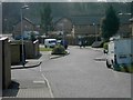

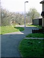
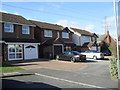
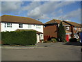
10 photos from this area
Area Information
Key information about the LU3 3TY including its size, population, and administrative classification.
- Area Type
- Postcode
- Area Size
- 9189 m²
- Population
- 1487
- Population Density
- 10942 people/km²
House Prices in LU3 3TY
36
Properties
£190,767
Average Sold Price
£70,000
Lowest Price
£290,000
Highest Price
Showing 36 properties
| Address | Type | Beds | Baths | Last Sale Price | Last Sale Date | |
|---|---|---|---|---|---|---|
| 69 Petersfield Gardens, Luton, LU3 3TY | house | - | - | £290,000 | Aug 2022 | |
| 42 Petersfield Gardens, Luton, LU3 3TY | Terraced | 3 | 1 | £270,000 | Jul 2022 | |
| 73 Petersfield Gardens, Luton, LU3 3TY | house | - | - | £255,000 | Dec 2021 | |
| 45 Petersfield Gardens, Luton, LU3 3TY | house | - | - | £220,000 | Feb 2021 | |
| 47 Petersfield Gardens, Luton, LU3 3TY | Terraced | 3 | 2 | £230,000 | Oct 2020 | |
| 67 Petersfield Gardens, Luton, LU3 3TY | Terraced | 3 | 1 | £235,000 | May 2018 | |
| 51 Petersfield Gardens, Luton, LU3 3TY | house | 3 | 1 | £196,000 | Apr 2018 | |
| 70 Petersfield Gardens, Luton, LU3 3TY | Terraced | 3 | 1 | £212,000 | Aug 2017 | |
| 40 Petersfield Gardens, Luton, LU3 3TY | Flat | 1 | 1 | £210,000 | Jul 2017 | |
| 64 Petersfield Gardens, Luton, LU3 3TY | Flat | - | - | £140,000 | Sep 2016 |
Page 1 of 4
Energy Efficiency in LU3 3TY
Amenities
Schools
| Rank | School | Type | Entry gender | Ages |
|---|
Explore more schools in this area
Go to Schools tabDemographics
Household Size
Family (3-5 people)
most common
Accommodation Type
Houses
most common
Tenure
46
majority
Ethnic Group
White
most common
Religion
N/A
most common
Household Composition
N/A
most common
Age
47
median
Adults (30-64 years)
most common
Household Deprivation
N/A
with no deprivation
NS-SEC
17
in Lower managerial occupations
Explore more demographic insights in this area
Go to Demographics tabPlanning
Planning Constraints
- Flood RiskPremium
- Ramsar Wetland SitesPremium
- Area of Outstanding Natural BeautyPremium
- Protected Nature ReservePremium
- Protected WoodlandPremium